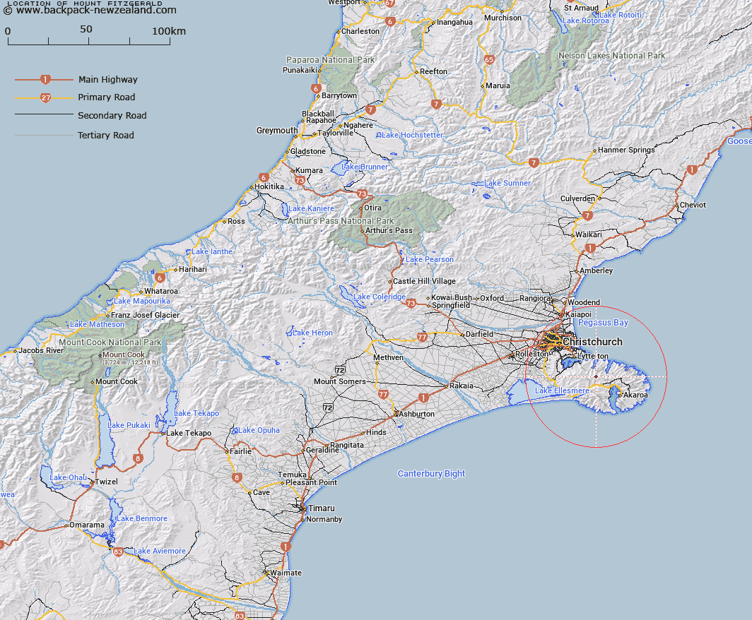
Map showing location of Mount Fitzgerald


LINZ description: Peak (height 826 metres) inland from the heads of Port Levy and Pigeon Bay, north of Little River.
Latitude: -43.70716
Longitude: 172.835918
Northing: 5160638.3
Easting: 1586780.3
Land District: Canterbury
Feat Type: Hill


Scroll down to see a more detailed road map and below that a topographical map showing the location of Mount Fitzgerald. The road map has been supplied by openstreetmap and the topographical map of Mount Fitzgerald has been supplied by Land Information New Zealand (LINZ).

Yes you can use the top static map for you school/university project or personal website with a link back. Contact me for any commercial use.

Mount Fitzgerald Map New Zealand


New Zealand places in our database
[ A ] [ B ] [ C ] [ D ] [ E ] [ F ] [ G ] [ H ] [ I ] [ J ] [ K ] [ L ] [ M ] [ N ] [ O ] [ P ] [ Q ] [ R ] [ S ] [ T ] [ U ] [ V ] [ W ] [ X ] [ Y ] [ Z ]


Closest 20 Hills to Mount Fitzgerald

Mount Sinclair ( 2.21km )   Wild Cattle Hill ( 4.19km )   The Monument ( 6.12km )   French Hill ( 7.05km )   Pigeon Bay Peak ( 7.23km )   Holmes ( 7.51km )   Mount Herbert/Te Ahu Patiki ( 7.84km )   Herbert Peak ( 7.84km )   Mount Herbert ( 7.84km )   Haytor ( 8.06km )   Pearce ( 8.09km )   Mount Evans ( 8.25km )   High Bare Peak ( 9.26km )   Zig Zag ( 9.88km )   Mount Bradley ( 10.21km )   Saddle Hill ( 10.62km )   Duvauchelle Peak ( 10.66km )   Rocky Peak ( 10.76km )   Graeme ( 11.33km )   View Hill ( 12.64km )   Te Oka ( 12.71km )   Okains Peak ( 13.04km )   Devils Gap ( 13.05km )   Takamatua Hill ( 13.43km )   Carews Peak ( 14.22km )   West Peak ( 14.37km )   Lavericks ( 15.19km )   Tauhinukorokio/Mount Pleasant ( 15.79km )   Tauhinukorokio ( 15.79km )   Windsor Castle ( 15.92km )   Benoit ( 15.95km )   Kaik Hill ( 16.02km )   Aylmers Hill ( 16.05km )   Mount Cavendish ( 16.24km )   Bossu ( 16.36km )   The Tors ( 17.04km )   Coopers Knob ( 17.77km )   Brasenose ( 18.35km )   Mount Vernon ( 18.47km )   Berard ( 18.54km )