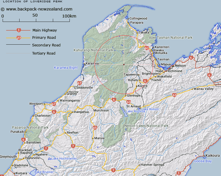
Map showing location of Loveridge Peak
LINZ description: Mountain, height 5,180 ft, situated at the head of Loveridge Track, between Ironstone and Loveridge Creeks, 3km South-west of The Twins in the Arthur Range. Block XIII Mount Arthur Survey District.
Latitude: -41.256579
Longitude: 172.630131
Northing: 5432693.7
Easting: 1569014.4
Land District: Nelson
Feat Type: Hill
Latitude: -41.256579
Longitude: 172.630131
Northing: 5432693.7
Easting: 1569014.4
Land District: Nelson
Feat Type: Hill

Scroll down to see a more detailed road map and below that a topographical map showing the location of Loveridge Peak. The road map has been supplied by openstreetmap and the topographical map of Loveridge Peak has been supplied by Land Information New Zealand (LINZ).
Yes you can use the top static map for you school/university project or personal website with a link back. Contact me for any commercial use.
[ A ] [ B ] [ C ] [ D ] [ E ] [ F ] [ G ] [ H ] [ I ] [ J ] [ K ] [ L ] [ M ] [ N ] [ O ] [ P ] [ Q ] [ R ] [ S ] [ T ] [ U ] [ V ] [ W ] [ X ] [ Y ] [ Z ]