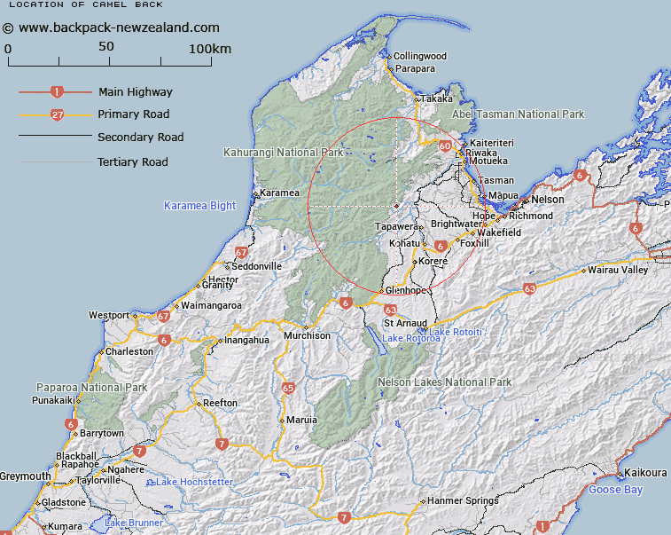
Map showing location of Camel Back


LINZ description: Two Limestone peaks 2km North of the Baton Plain, Trig. 2 (Geodetic Code AN0X) on summit. Block III Mount Arthur Survey District.
Latitude: -41.295535
Longitude: 172.717506
Northing: 5428396.4
Easting: 1576348.2
Land District: Nelson
Feat Type: Hill


Scroll down to see a more detailed road map and below that a topographical map showing the location of Camel Back. The road map has been supplied by openstreetmap and the topographical map of Camel Back has been supplied by Land Information New Zealand (LINZ).

Yes you can use the top static map for you school/university project or personal website with a link back. Contact me for any commercial use.

Camel Back Map New Zealand


New Zealand places in our database
[ A ] [ B ] [ C ] [ D ] [ E ] [ F ] [ G ] [ H ] [ I ] [ J ] [ K ] [ L ] [ M ] [ N ] [ O ] [ P ] [ Q ] [ R ] [ S ] [ T ] [ U ] [ V ] [ W ] [ X ] [ Y ] [ Z ]


Closest 20 Hills to Camel Back

Sugar Loaf ( 3.15km )   Barron Bold ( 4.8km )   Thomson Hill ( 5.64km )   The Twins ( 8.02km )   Blue Rock ( 8.41km )   Loveridge Peak ( 8.49km )   Winter Peak ( 8.79km )   Mount Arthur ( 9.15km )   Stanley Brook Hill ( 9.75km )   Battery Hill ( 10.31km )   Sugar Loaf ( 10.42km )   Mount Star ( 11.59km )   Gordons Pyramid ( 12.01km )   Mount Jones ( 12.48km )   Mount Sodom ( 13.39km )   Mount Thomas ( 13.46km )   Lodestone ( 14.12km )   Mount Gomorrah ( 14.29km )   Tableland ( 14.5km )   Mount Hodder ( 14.87km )   Balloon Hill ( 15.96km )   Mount Olive ( 16.09km )   Mount Baldy ( 16.49km )   Old Sow ( 16.52km )   Mount McMahon ( 16.81km )   Mount Crusader ( 17.9km )   Devils Thumb ( 18.5km )   Hoary Head ( 19.4km )   Mount Peel ( 20.39km )   Mount Campbell ( 22.18km )   Pukeone / Mount Campbell ( 22.18km )   Mount Patriarch ( 22.46km )   Mount Mytton ( 22.86km )   Sandy Peak ( 23.01km )   Iron Hill ( 23.5km )   Mount Luna ( 24km )   Hailes Knob ( 24.07km )   Mount Norris ( 25.19km )   Mount Norriss ( 25.19km )   Mount Lockett ( 25.86km )