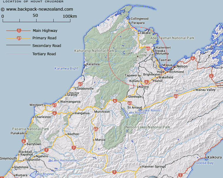
Map showing location of Mount Crusader


LINZ description: Mountain at height 1428m, located between Mount McMahon and Hoary Head in the Arthur Range, with an un-beaconed trig station "A6MC, F Crusader" at its summit.
Latitude: -41.144964
Longitude: 172.793048
Northing: 5445129.7
Easting: 1582633.2
Land District: Nelson
Feat Type: Hill


Scroll down to see a more detailed road map and below that a topographical map showing the location of Mount Crusader. The road map has been supplied by openstreetmap and the topographical map of Mount Crusader has been supplied by Land Information New Zealand (LINZ).

Yes you can use the top static map for you school/university project or personal website with a link back. Contact me for any commercial use.

Mount Crusader Map New Zealand


New Zealand places in our database
[ A ] [ B ] [ C ] [ D ] [ E ] [ F ] [ G ] [ H ] [ I ] [ J ] [ K ] [ L ] [ M ] [ N ] [ O ] [ P ] [ Q ] [ R ] [ S ] [ T ] [ U ] [ V ] [ W ] [ X ] [ Y ] [ Z ]


Closest 20 Hills to Mount Crusader

Mount McMahon ( 1.15km )   Hoary Head ( 1.58km )   Lodestone ( 4.86km )   Mount Campbell ( 5.51km )   Pukeone / Mount Campbell ( 5.51km )   Mount Hodder ( 5.53km )   Hailes Knob ( 6.19km )   Sugar Loaf ( 7.77km )   Mount Thomas ( 10.23km )   Gordons Pyramid ( 10.81km )   Winter Peak ( 12.22km )   Mount Arthur ( 12.34km )   Barron Bold ( 13.41km )   Tableland ( 14.74km )   Balloon Hill ( 14.77km )   The Twins ( 15.47km )   Iron Hill ( 16.14km )   Mount Peel ( 16.89km )   Mount Lockett ( 16.94km )   Pikikiruna ( 17.21km )   Pikikirunga ( 17.21km )   Camel Back ( 17.9km )   Mount Mytton ( 18.24km )   Loveridge Peak ( 18.43km )   Mount Benson ( 19.84km )   Mount Snowdon ( 20.09km )   Mount Snowden ( 20.09km )   Sugar Loaf ( 20.77km )   Pukekoikoi Hill ( 20.94km )   Stanley Brook Hill ( 22.21km )   Devil River Peak ( 22.61km )   Thomson Hill ( 23.26km )   Mount Ranolf ( 23.37km )   Mount Prospect ( 23.67km )   K?k?p? Peak ( 24.08km )   Mount Evans ( 24.22km )   Waingaro Peak ( 24.29km )   Blue Rock ( 25.33km )   Mount Cobb ( 25.96km )   Pisgah Hill ( 25.97km )