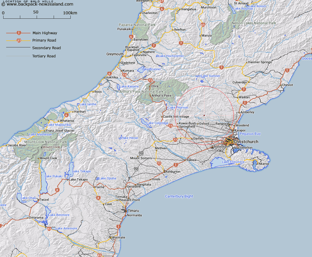
Map showing location of Bald Hills


LINZ description: Hills approximately 2miles north of Glentui on east side of Bald Hill Stream between Glentui and Garry Rivers.
Latitude: -43.194677
Longitude: 172.274243
Northing: 5217310.6
Easting: 1541031.7
Land District: Canterbury
Feat Type: Hill


Scroll down to see a more detailed road map and below that a topographical map showing the location of Bald Hills. The road map has been supplied by openstreetmap and the topographical map of Bald Hills has been supplied by Land Information New Zealand (LINZ).

Yes you can use the top static map for you school/university project or personal website with a link back. Contact me for any commercial use.

Bald Hills Map New Zealand


New Zealand places in our database
[ A ] [ B ] [ C ] [ D ] [ E ] [ F ] [ G ] [ H ] [ I ] [ J ] [ K ] [ L ] [ M ] [ N ] [ O ] [ P ] [ Q ] [ R ] [ S ] [ T ] [ U ] [ V ] [ W ] [ X ] [ Y ] [ Z ]


Closest 20 Hills to Bald Hills

Knowles Top ( 3.07km )   Mount Richardson ( 4.47km )   Mount Thomas ( 6.97km )   Bottle Hill ( 7.37km )   Ashley Hill ( 8.07km )   Ladbrooks Hill ( 8.35km )   Round Hill ( 10.29km )   Starvation Hill ( 10.77km )   Retreat Hill ( 11.09km )   Mairaki Downs ( 11.9km )   Island Hill ( 12.54km )   Okuku Hill ( 12.95km )   Oxford Hill ( 14.83km )   Mount Oxford ( 15.6km )   Mount Storm ( 15.65km )   Pancake Hill ( 16.68km )   Spring Hill ( 17.8km )   Mount Karetu ( 18.82km )   Lilburne Hill ( 20.19km )   Lillburn Hill ( 20.19km )   Mount Gordon ( 20.86km )   Mount Pember ( 21.94km )   Black Hill ( 22.68km )   Chest Peak ( 22.97km )   Puketeraki ( 23.01km )   Wilson Hill ( 23.07km )   View Hill ( 23.19km )   Burnt Hill ( 23.38km )   Blue Mountain ( 23.75km )   Mount Grey/Maukatere ( 23.86km )   Mount Grey ( 23.86km )   Fosters Hill ( 24.18km )   Block Hill ( 24.85km )   Latter Hill ( 25.36km )   Devils Den ( 26.01km )   Mount MacDonald ( 26.31km )   Ashley Head ( 26.67km )   Nalder ( 26.71km )   Gorge Hill ( 26.72km )   Rocks ( 26.93km )