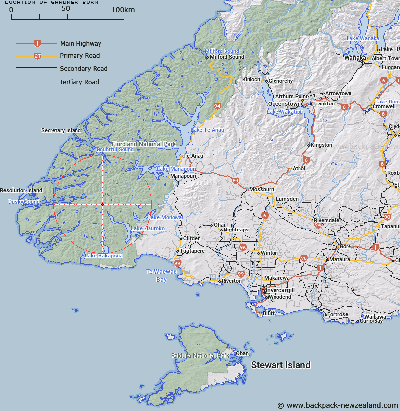
Map showing location of Gardner Burn


LINZ description: The large south-easterly flowing tributary of the Hauroko Burn, which has several sources on the south eastern slopes of the Heath Mountains.
Latitude: -45.774844
Longitude: 167.102713
Northing: 4914030.9
Easting: 1141532.7
Land District: Southland
Feat Type: Stream


Scroll down to see a more detailed road map and below that a topographical map showing the location of Gardner Burn. The road map has been supplied by openstreetmap and the topographical map of Gardner Burn has been supplied by Land Information New Zealand (LINZ).

Yes you can use the top static map for you school/university project or personal website with a link back. Contact me for any commercial use.

Gardner Burn Map New Zealand


New Zealand places in our database
[ A ] [ B ] [ C ] [ D ] [ E ] [ F ] [ G ] [ H ] [ I ] [ J ] [ K ] [ L ] [ M ] [ N ] [ O ] [ P ] [ Q ] [ R ] [ S ] [ T ] [ U ] [ V ] [ W ] [ X ] [ Y ] [ Z ]


Closest 20 Streams to Gardner Burn

Gardner Burn ( 0km )   Hay River ( 5.67km )   Hauroko Burn ( 6.08km )   Roa Stream ( 7.8km )   Jane Burn ( 9.24km )   Russet Burn ( 9.58km )   Long Burn ( 10.54km )   Jaquiery Stream ( 11.85km )   Deadwood Creek ( 11.85km )   Florence Stream ( 12.18km )   Macfarlane Stream ( 12.55km )   Electric River ( 13.21km )   Bishop Burn ( 14.04km )   Bessie Burn ( 14.72km )   Florence Stream North Branch ( 15.16km )   Princess Burn ( 15.3km )   Mike River ( 15.4km )   Fowler Stream ( 15.41km )   Henry Burn ( 15.49km )   Hilda Burn ( 16.29km )   Grebe River ( 16.82km )   Kintail Stream ( 17.91km )   Kenneth Burn ( 18.21km )   Dunlop Stream ( 18.95km )   Herrick Creek ( 19.68km )   Rooney River ( 19.69km )   Seaforth River ( 20.99km )   Warren Burn ( 21.24km )   Emerald Stream ( 22km )   Wynne Burn ( 22.13km )   Wynn Burn ( 22.13km )   Oho Creek ( 22.53km )   Cockburn Stream ( 22.84km )   Richard Burn ( 22.91km )   Diamond Creek ( 23.36km )   Eel Creek ( 23.75km )   Shott Stream ( 24.21km )   Sholl Stream ( 24.21km )   Waterfall Creek ( 24.62km )   Margaret Stream ( 25km )