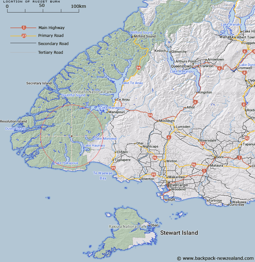
Map showing location of Russet Burn


LINZ description: The large stream to the east of Hauroko Burn, rises in south-eastern Merrie Range and flows almost due east into the northern end of Lake Hauroko; Fiordland National Park
Latitude: -45.842419
Longitude: 167.179471
Northing: 4906963
Easting: 1148048.1
Land District: Southland
Feat Type: Stream


Scroll down to see a more detailed road map and below that a topographical map showing the location of Russet Burn. The road map has been supplied by openstreetmap and the topographical map of Russet Burn has been supplied by Land Information New Zealand (LINZ).

Yes you can use the top static map for you school/university project or personal website with a link back. Contact me for any commercial use.

Russet Burn Map New Zealand


New Zealand places in our database
[ A ] [ B ] [ C ] [ D ] [ E ] [ F ] [ G ] [ H ] [ I ] [ J ] [ K ] [ L ] [ M ] [ N ] [ O ] [ P ] [ Q ] [ R ] [ S ] [ T ] [ U ] [ V ] [ W ] [ X ] [ Y ] [ Z ]


Closest 20 Streams to Russet Burn

Electric River ( 4.65km )   Hay River ( 7.6km )   Gardner Burn ( 9.58km )   Rooney River ( 10.22km )   Princess Burn ( 10.48km )   Jaquiery Stream ( 10.84km )   Fowler Stream ( 11.09km )   Hauroko Burn ( 12.97km )   Grebe River ( 14.52km )   Eel Creek ( 14.98km )   Florence Stream ( 15.66km )   Long Burn ( 16.56km )   Caroline Burn ( 17.22km )   Roa Stream ( 17.37km )   Jane Burn ( 18.47km )   Dunlop Stream ( 18.78km )   Florence Stream North Branch ( 19.16km )   Deadwood Creek ( 19.43km )   Rata Burn ( 20.2km )   Mike River ( 21.47km )   Richard Burn ( 21.64km )   Walker River ( 21.97km )   Macfarlane Stream ( 22.14km )   Bessie Burn ( 23.03km )   Bishop Burn ( 23.4km )   Pig Creek ( 24km )   Borland Burn South Branch ( 24.12km )   Margaret Stream ( 24.58km )   Borland Burn Middle Branch ( 24.62km )   Henry Burn ( 25.07km )   Hilda Burn ( 25.54km )   Kintail Stream ( 25.6km )   Kenneth Burn ( 27km )   Emerald Stream ( 27.32km )   Hindley Burn ( 27.38km )   Jeanie Burn ( 27.64km )   Thicket Burn ( 28.15km )   Borland Burn ( 28.21km )   Warren Burn ( 28.42km )   Oho Creek ( 28.46km )