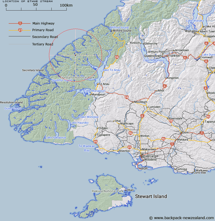
Map showing location of Ethne Stream


LINZ description: Small tributary of Stillwater River arising on saddle to the south-east of the head of the south-west arm of George Sound. Previously described as flowing into George Sound
Latitude: -45.009352
Longitude: 167.399312
Northing: 5000730.8
Easting: 1158652
Land District: Southland
Feat Type: Stream


Scroll down to see a more detailed road map and below that a topographical map showing the location of Ethne Stream. The road map has been supplied by openstreetmap and the topographical map of Ethne Stream has been supplied by Land Information New Zealand (LINZ).

Yes you can use the top static map for you school/university project or personal website with a link back. Contact me for any commercial use.

Ethne Stream Map New Zealand


New Zealand places in our database
[ A ] [ B ] [ C ] [ D ] [ E ] [ F ] [ G ] [ H ] [ I ] [ J ] [ K ] [ L ] [ M ] [ N ] [ O ] [ P ] [ Q ] [ R ] [ S ] [ T ] [ U ] [ V ] [ W ] [ X ] [ Y ] [ Z ]


Closest 20 Streams to Ethne Stream

Overlander Stream ( 2.4km )   Katherine Creek ( 4.01km )   Nita Creek ( 4.33km )   Feldspar Stream ( 5.17km )   Madman Stream ( 5.2km )   Expectation Stream ( 6.99km )   Stillwater River ( 7.65km )   Whitewater River ( 8.77km )   Large Burn ( 8.89km )   Edith River ( 9.42km )   Rugged Burn ( 9.71km )   West Burn ( 9.71km )   Campbell Creek ( 9.95km )   Trophy Burn ( 11.19km )   Pisgah Creek ( 11.58km )   Barrier Stream ( 11.62km )   Rugged Burn ( 11.69km )   Wapiti River ( 11.69km )   George River ( 11.85km )   Doon River ( 13.3km )   Canyon Creek ( 14.7km )   McDonald Creek ( 14.97km )   Irene River ( 16km )   Midnight Creek ( 16.16km )   Junction Burn ( 16.44km )   Pitt River ( 16.82km )   Jennings Burn ( 17.86km )   McIvor Burn ( 18.58km )   Wild Natives River ( 19.18km )   Austral Creek ( 19.57km )   Juno River ( 19.83km )   Inaccessible Creek ( 20.25km )   Henderson Burn ( 20.73km )   Taheke Creek ( 20.74km )   Woodrow Burn ( 21.03km )   Bernard Burn ( 21.6km )   Stina Burn ( 22.06km )   Glaisnock River ( 22.73km )   Kakapo Creek ( 22.84km )   Wisely Burn ( 23.29km )