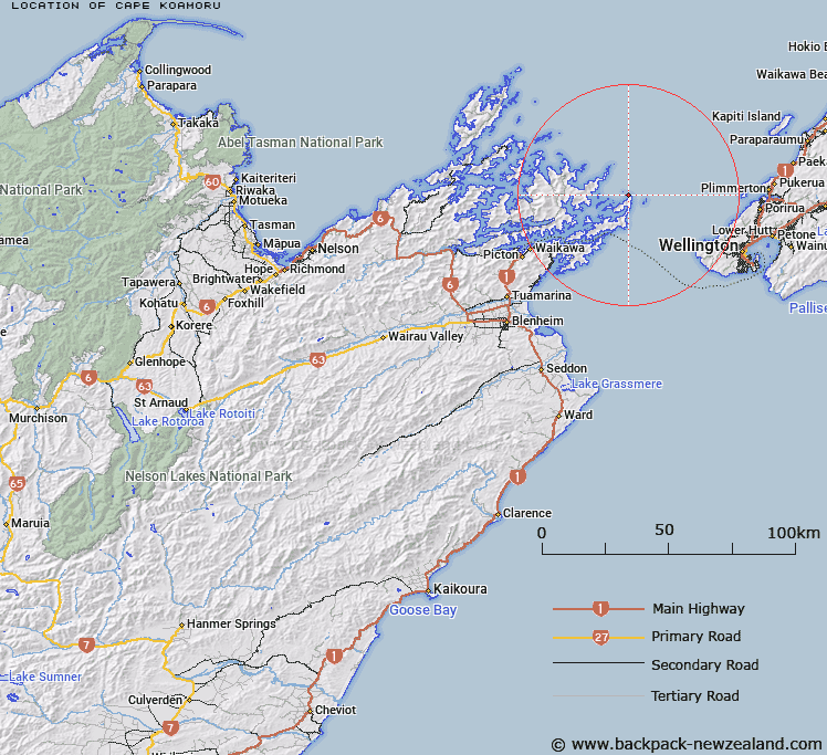
Map showing location of Cape Koamoru
LINZ description: East of Long Island in Queen Charlotte Sound (Totaranui), Malborough Sounds. Feature shown on: NZMS260 Q26 Pt P26
Latitude: -41.088496
Longitude: 174.381116
Northing: 5450500
Easting: 1716000
Land District: Marlborough
Feat Type: Cape
Latitude: -41.088496
Longitude: 174.381116
Northing: 5450500
Easting: 1716000
Land District: Marlborough
Feat Type: Cape

Scroll down to see a more detailed road map and below that a topographical map showing the location of Cape Koamoru. The road map has been supplied by openstreetmap and the topographical map of Cape Koamoru has been supplied by Land Information New Zealand (LINZ).
Yes you can use the top static map for you school/university project or personal website with a link back. Contact me for any commercial use.
[ A ] [ B ] [ C ] [ D ] [ E ] [ F ] [ G ] [ H ] [ I ] [ J ] [ K ] [ L ] [ M ] [ N ] [ O ] [ P ] [ Q ] [ R ] [ S ] [ T ] [ U ] [ V ] [ W ] [ X ] [ Y ] [ Z ]