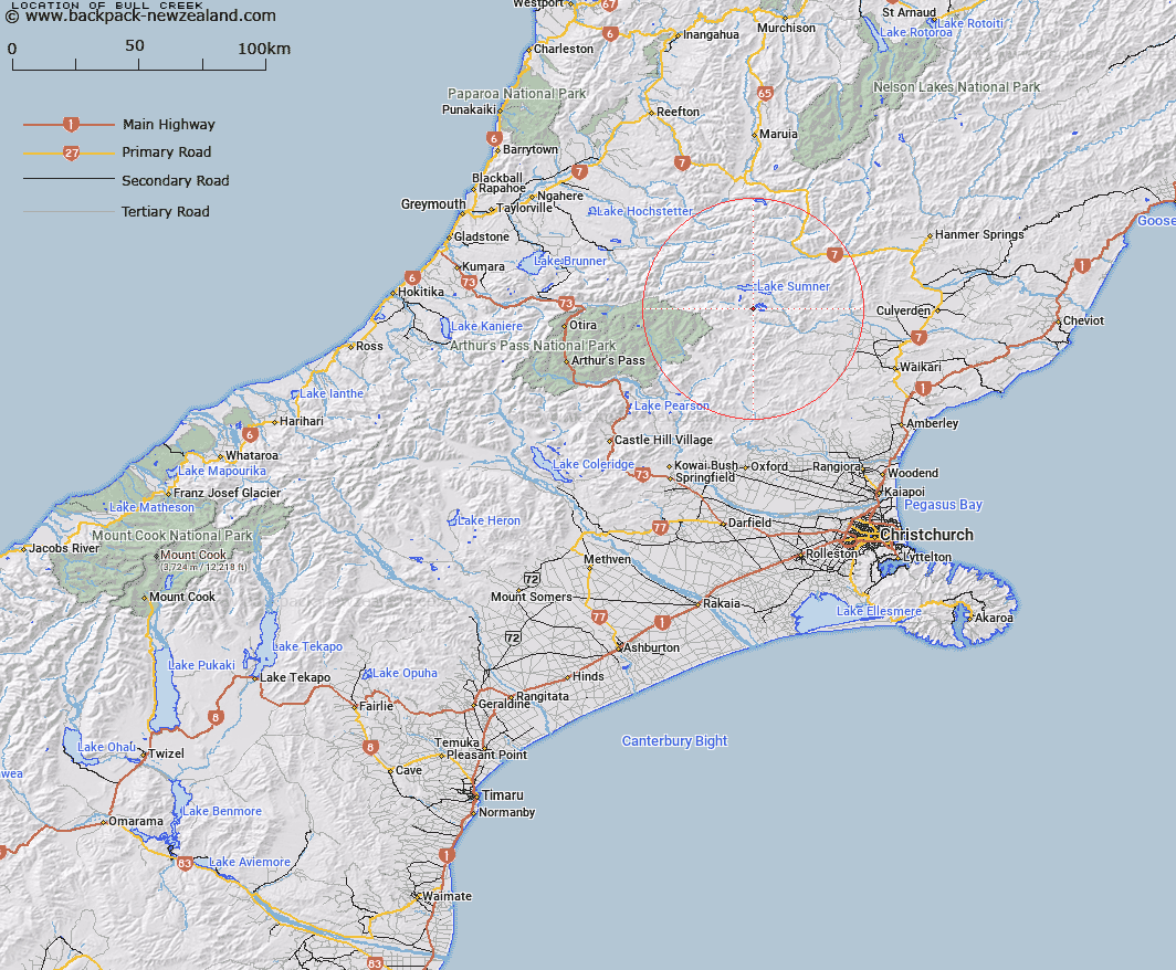
Map showing location of Bull Creek


LINZ description: Sourced in the Dampier Range, flows west of The Candlesticks and south into the Cox River
Latitude: -42.767536
Longitude: 172.214082
Northing: 5264700
Easting: 1535700
Land District: Canterbury
Feat Type: Stream


Scroll down to see a more detailed road map and below that a topographical map showing the location of Bull Creek. The road map has been supplied by openstreetmap and the topographical map of Bull Creek has been supplied by Land Information New Zealand (LINZ).

Yes you can use the top static map for you school/university project or personal website with a link back. Contact me for any commercial use.

Bull Creek Map New Zealand


New Zealand places in our database
[ A ] [ B ] [ C ] [ D ] [ E ] [ F ] [ G ] [ H ] [ I ] [ J ] [ K ] [ L ] [ M ] [ N ] [ O ] [ P ] [ Q ] [ R ] [ S ] [ T ] [ U ] [ V ] [ W ] [ X ] [ Y ] [ Z ]


Closest 20 Streams to Bull Creek

Bull Stream ( 0.34km )   Flax Stream ( 2.2km )   Homestead Stream ( 4.02km )   Mason Stream ( 4.07km )   Sisters Stream ( 4.65km )   Bush Stream ( 4.68km )   The Canal ( 6.63km )   Zigzag Creek ( 7.22km )   Zig Zag Stream ( 7.36km )   Taylor Stream ( 7.7km )   Valley Stream ( 7.91km )   Lagoon Stream ( 7.93km )   Deep Stream ( 8.11km )   Nurse Stream ( 8.25km )   Gabriel Stream ( 8.36km )   Woollies Stream ( 8.42km )   Evangeline Stream ( 8.51km )   Stony Stream ( 8.53km )   Kennedy Stream ( 8.54km )   Marion Stream ( 9.04km )   Dearden Stream ( 10.3km )   Bridge Stream ( 10.42km )   Bush Gully Stream ( 10.57km )   North Esk River ( 10.67km )   Crossley Stream ( 10.79km )   Lucy Stream ( 10.93km )   Woolshed Stream ( 11.11km )   Rough Stream ( 11.13km )   Three Mile Stream ( 11.22km )   Jollie Brook ( 11.66km )   Parakeet Stream ( 12.06km )   The Forks ( 12.14km )   McMillan Stream ( 12.75km )   Horseshoe Stream ( 12.91km )   Trumper Stream ( 13.18km )   Anderson Stream ( 13.21km )   Clay Spur Stream ( 13.33km )   Kiwi River ( 13.88km )   Woodchopper Stream ( 14.04km )   Dozy Stream ( 14.23km )