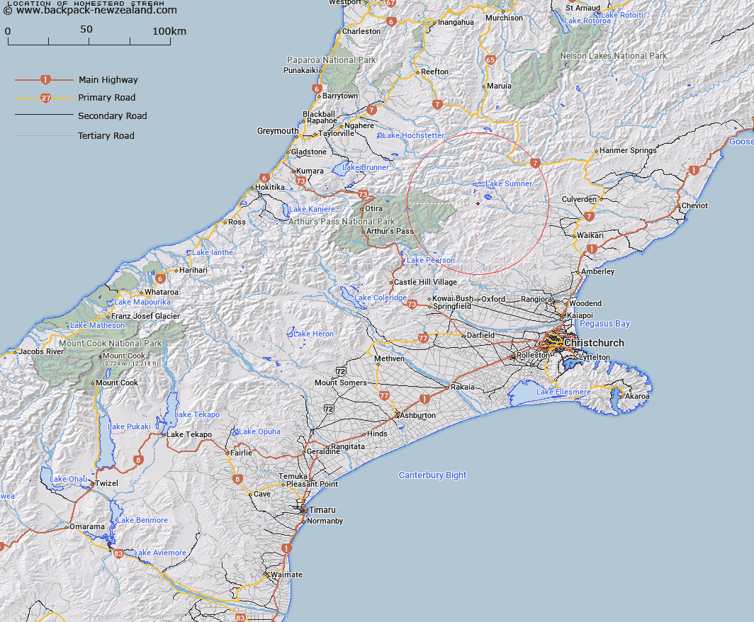
Map showing location of Homestead Stream


LINZ description: Stream rising under ridge at east of Studleigh Range - flows east past end of Island hills into South Branch Hurunui River
Latitude: -42.798595
Longitude: 172.188979
Northing: 5261231.6
Easting: 1533679.3
Land District: Canterbury
Feat Type: Stream


Scroll down to see a more detailed road map and below that a topographical map showing the location of Homestead Stream. The road map has been supplied by openstreetmap and the topographical map of Homestead Stream has been supplied by Land Information New Zealand (LINZ).

Yes you can use the top static map for you school/university project or personal website with a link back. Contact me for any commercial use.

Homestead Stream Map New Zealand


New Zealand places in our database
[ A ] [ B ] [ C ] [ D ] [ E ] [ F ] [ G ] [ H ] [ I ] [ J ] [ K ] [ L ] [ M ] [ N ] [ O ] [ P ] [ Q ] [ R ] [ S ] [ T ] [ U ] [ V ] [ W ] [ X ] [ Y ] [ Z ]


Closest 20 Streams to Homestead Stream

Homestead Stream ( 0km )   Bull Stream ( 3.77km )   Bull Creek ( 4.02km )   Flax Stream ( 4.08km )   Woollies Stream ( 4.66km )   Deep Stream ( 4.74km )   Mason Stream ( 5.24km )   Valley Stream ( 5.59km )   Zigzag Creek ( 5.61km )   Zig Zag Stream ( 5.7km )   Kennedy Stream ( 6.03km )   Bush Gully Stream ( 6.58km )   Lagoon Stream ( 6.64km )   Lucy Stream ( 6.96km )   Bush Stream ( 7km )   Crossley Stream ( 7.24km )   Sisters Stream ( 7.35km )   North Esk River ( 7.71km )   Stony Stream ( 7.87km )   Bridge Stream ( 8.37km )   Anderson Stream ( 9.43km )   The Canal ( 9.65km )   Taylor Stream ( 9.85km )   Woolshed Stream ( 10.43km )   Nurse Stream ( 11.54km )   Clay Spur Stream ( 11.63km )   Dearden Stream ( 11.67km )   Rough Stream ( 11.88km )   Trumper Stream ( 11.89km )   Fossil Stream ( 12.01km )   Gabriel Stream ( 12.24km )   Candlestick Stream ( 12.35km )   Evangeline Stream ( 12.45km )   Waterfall Stream ( 12.62km )   Marion Stream ( 12.82km )   Horseshoe Stream ( 13.05km )   Fooks Stream ( 13.09km )   Seaward River ( 13.54km )   Dust Stream ( 13.8km )   Bull Creek ( 13.9km )