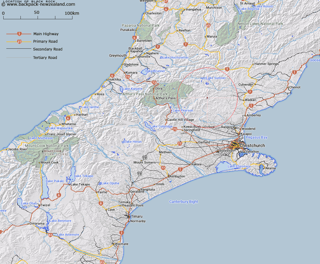
Map showing location of Black Rock


LINZ description: Prominent black peak behind Mt. Whatno on the Puketeraki Range
Latitude: -42.938187
Longitude: 172.246282
Northing: 5245773.8
Easting: 1538504
Land District: Canterbury
Feat Type: Rock


Scroll down to see a more detailed road map and below that a topographical map showing the location of Black Rock. The road map has been supplied by openstreetmap and the topographical map of Black Rock has been supplied by Land Information New Zealand (LINZ).

Yes you can use the top static map for you school/university project or personal website with a link back. Contact me for any commercial use.

Black Rock Map New Zealand


New Zealand places in our database
[ A ] [ B ] [ C ] [ D ] [ E ] [ F ] [ G ] [ H ] [ I ] [ J ] [ K ] [ L ] [ M ] [ N ] [ O ] [ P ] [ Q ] [ R ] [ S ] [ T ] [ U ] [ V ] [ W ] [ X ] [ Y ] [ Z ]


Closest 20 Rocks to Black Rock

Brassington Rocks ( 32.62km )   Windy Point ( 40.81km )   Parapet Rock ( 49.92km )   The Spike ( 51.03km )   The Pinnacles ( 61.02km )   Cascade Rock ( 65.51km )   Grevilles Cone ( 67.98km )   Fort Jackson ( 69.93km )   John Browns Tomb ( 79.02km )   Sail Rock ( 79.4km )   Shag Rock ( 80.64km )   Castle Rock ( 80.91km )   Tihiokahukura/Castle Rock ( 80.91km )   Cave Rock ( 81.23km )   Gibraltar Rock ( 85.35km )   The Cathedrals ( 86.13km )   Big Rock ( 89.94km )   Lions Head ( 90.87km )   Remarkable Dykes ( 92.18km )   The Temple ( 92.69km )   Motukiekie Rocks ( 105.25km )   Pulpit Rock ( 107.24km )   Boaz ( 110.82km )   Hells Gate ( 112.12km )   Pinnacle Rock ( 114.22km )   Blue Rock ( 115.64km )   Moses Rock ( 116.3km )   Pancake Rocks ( 118.39km )   Ballroom Overhang ( 119.29km )   Gentle Annie Rocks ( 120.73km )   The Barracks ( 120.87km )   Pinnacle Rock ( 122.15km )   Robinson Slip ( 123.33km )   Tytler Rocks ( 126.45km )   Hole in the Hill ( 126.57km )   Parachute Rocks ( 134.49km )   Harleys Rock ( 141.52km )   Grenadier Rocks ( 163.76km )   Luna Slips ( 171.34km )   Teichelmann Rock ( 176.78km )