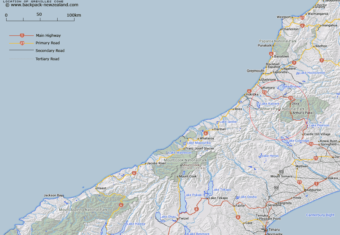
Map showing location of Grevilles Cone


LINZ description: NZTopo50-BV20 704480. Located at the north end of McLaurin Range in the Southern Alps / Kā Tiritiri o te Moana, approximately 40km southeast of Hokitika.
Latitude: -42.90925
Longitude: 171.412323
Northing: 5248040.1
Easting: 1470399.6
Land District: Westland
Feat Type: Rock


Scroll down to see a more detailed road map and below that a topographical map showing the location of Grevilles Cone. The road map has been supplied by openstreetmap and the topographical map of Grevilles Cone has been supplied by Land Information New Zealand (LINZ).

Yes you can use the top static map for you school/university project or personal website with a link back. Contact me for any commercial use.

Grevilles Cone Map New Zealand


New Zealand places in our database
[ A ] [ B ] [ C ] [ D ] [ E ] [ F ] [ G ] [ H ] [ I ] [ J ] [ K ] [ L ] [ M ] [ N ] [ O ] [ P ] [ Q ] [ R ] [ S ] [ T ] [ U ] [ V ] [ W ] [ X ] [ Y ] [ Z ]


Closest 20 Rocks to Grevilles Cone

Grevilles Cone ( 0km )   Cascade Rock ( 2.88km )   The Spike ( 18.13km )   The Pinnacles ( 32.23km )   Parapet Rock ( 39.49km )   Brassington Rocks ( 51.16km )   Robinson Slip ( 58.11km )   Moses Rock ( 63.19km )   Fort Jackson ( 64.78km )   Motukiekie Rocks ( 65.96km )   Black Rock ( 67.98km )   Windy Point ( 86.51km )   Pancake Rocks ( 88.4km )   Gentle Annie Rocks ( 92.89km )   Ballroom Overhang ( 96.32km )   Hole in the Hill ( 106.61km )   Teichelmann Rock ( 115.94km )   Wilson Rock ( 116.48km )   Gibraltar Rock ( 127.74km )   Castle Rock ( 128.57km )   Tihiokahukura/Castle Rock ( 128.57km )   Shag Rock ( 130.54km )   Cave Rock ( 131.34km )   Blue Rock ( 134.34km )   Big Rock ( 135.28km )   Remarkable Dykes ( 135.42km )   Lions Head ( 137.88km )   The Temple ( 139.96km )   Rock Etam ( 141.98km )   Tomnahurich Rock ( 143.09km )   John Browns Tomb ( 146.99km )   Sail Rock ( 147.38km )   Red Slip ( 151.01km )   Boaz ( 152.23km )   Pulpit Rock ( 153.26km )   Hells Gate ( 153.68km )   The Cathedrals ( 153.81km )   Scotts Slip ( 154.27km )   The Sentinel ( 155.84km )   Pinnacle Rock ( 160.73km )