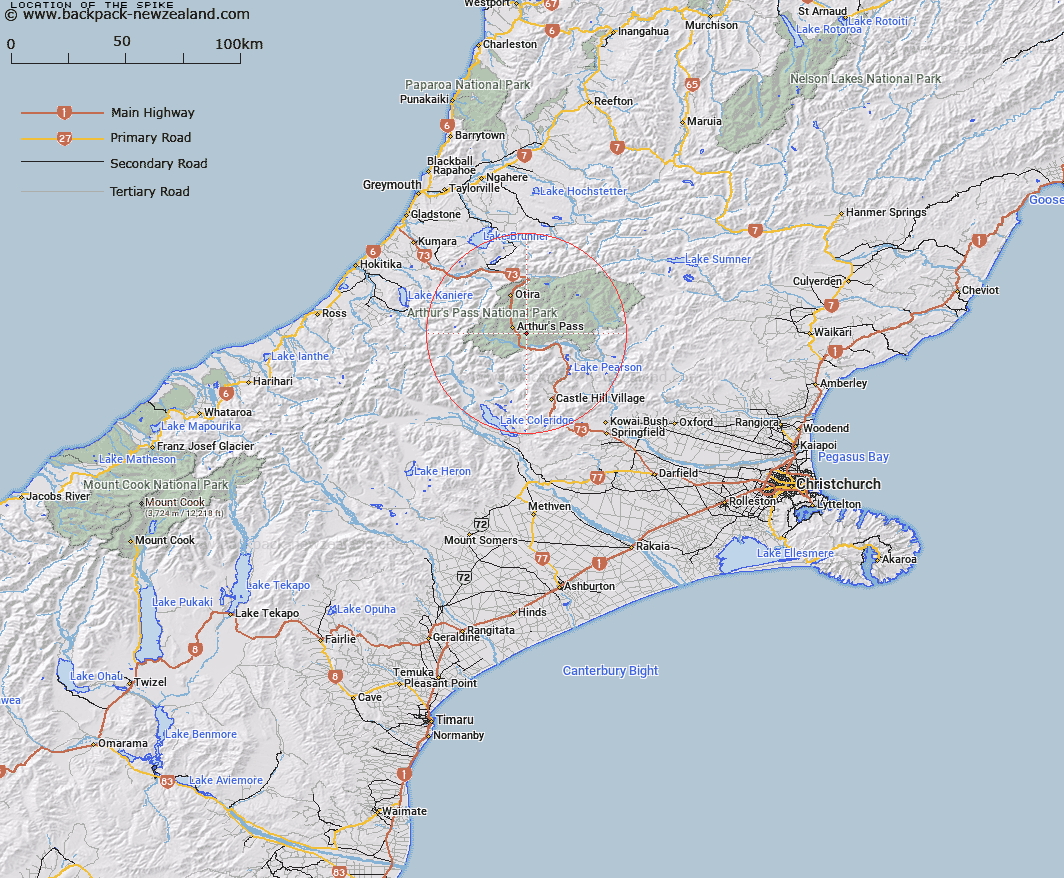
Map showing location of The Spike


LINZ description: Rock tooth on the ridge leading from the Edwards-Mingha junction to the summit of Mount Williams
Latitude: -42.96724
Longitude: 171.620516
Northing: 5241900
Easting: 1487500
Land District: Canterbury
Feat Type: Rock


Scroll down to see a more detailed road map and below that a topographical map showing the location of The Spike. The road map has been supplied by openstreetmap and the topographical map of The Spike has been supplied by Land Information New Zealand (LINZ).

Yes you can use the top static map for you school/university project or personal website with a link back. Contact me for any commercial use.

The Spike Map New Zealand


New Zealand places in our database
[ A ] [ B ] [ C ] [ D ] [ E ] [ F ] [ G ] [ H ] [ I ] [ J ] [ K ] [ L ] [ M ] [ N ] [ O ] [ P ] [ Q ] [ R ] [ S ] [ T ] [ U ] [ V ] [ W ] [ X ] [ Y ] [ Z ]


Closest 20 Rocks to The Spike

Cascade Rock ( 16.36km )   Grevilles Cone ( 18.13km )   The Pinnacles ( 23.53km )   Parapet Rock ( 25.14km )   Brassington Rocks ( 33.41km )   Black Rock ( 51.03km )   Fort Jackson ( 53.68km )   Moses Rock ( 70.64km )   Robinson Slip ( 72.61km )   Windy Point ( 74.89km )   Motukiekie Rocks ( 77km )   Pancake Rocks ( 97.58km )   Gentle Annie Rocks ( 101.6km )   Ballroom Overhang ( 103.75km )   Gibraltar Rock ( 110.91km )   Castle Rock ( 111.2km )   Tihiokahukura/Castle Rock ( 111.2km )   Shag Rock ( 112.99km )   Hole in the Hill ( 113.54km )   Cave Rock ( 113.77km )   Big Rock ( 118.21km )   Remarkable Dykes ( 118.58km )   Lions Head ( 120.66km )   The Temple ( 122.73km )   Teichelmann Rock ( 128.1km )   Wilson Rock ( 128.62km )   John Browns Tomb ( 129.94km )   Sail Rock ( 130.24km )   Blue Rock ( 131.55km )   Boaz ( 135.8km )   Pulpit Rock ( 136.27km )   The Cathedrals ( 137.16km )   Hells Gate ( 137.24km )   Pinnacle Rock ( 143.74km )   Rock Etam ( 150.39km )   Tomnahurich Rock ( 150.73km )   Red Slip ( 159.11km )   Dashing Rocks ( 159.47km )   Scotts Slip ( 162.08km )   The Barracks ( 162.93km )