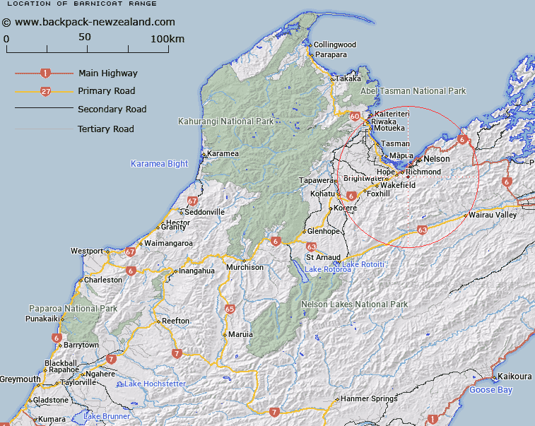
Map showing location of Barnicoat Range


LINZ description: Running south-westerly from Jenkins Hill Trig.Station to Waimea River. Waimea Survey District.
Latitude: -41.363692
Longitude: 173.215447
Northing: 5420846
Easting: 1618019.5
Land District: Nelson
Feat Type: Range


Scroll down to see a more detailed road map and below that a topographical map showing the location of Barnicoat Range. The road map has been supplied by openstreetmap and the topographical map of Barnicoat Range has been supplied by Land Information New Zealand (LINZ).

Yes you can use the top static map for you school/university project or personal website with a link back. Contact me for any commercial use.

Barnicoat Range Map New Zealand


New Zealand places in our database
[ A ] [ B ] [ C ] [ D ] [ E ] [ F ] [ G ] [ H ] [ I ] [ J ] [ K ] [ L ] [ M ] [ N ] [ O ] [ P ] [ Q ] [ R ] [ S ] [ T ] [ U ] [ V ] [ W ] [ X ] [ Y ] [ Z ]


Closest 20 Ranges to Barnicoat Range

Bryant Range ( 9.64km )   Richmond Range ( 20.25km )   Spooners Range ( 28.22km )   Gordon Range ( 33.99km )   Bull Range ( 43.38km )   Pinchback Range ( 44.99km )   Pyramid Ridge ( 48.35km )   Wharepapa / Arthur Range ( 48.6km )   Arthur Range ( 48.6km )   Lookout Range ( 55.09km )   Hope Range ( 57.77km )   Pikikiruna Range ( 58.03km )   Pikikirunga Range ( 58.03km )   Back Grey Hills ( 58.79km )   Lockett Range ( 59.51km )   Raglan Range ( 61km )   Junction Range ( 61.64km )   Blairich Range ( 62.36km )   Devil Range ( 62.83km )   Schooner Range ( 63.39km )   Snowden Range ( 64.06km )   Snowdon Range ( 64.06km )   Front Grey Hills ( 64.47km )   Black Birch Range ( 65.4km )   Anatoki Range ( 66.04km )   Wither Hills ( 67.34km )   Allen Range ( 68.14km )   Douglas Range ( 69.08km )   Robertson Range ( 69.16km )   Muntz Range ( 69.5km )   Peel Range ( 69.9km )   Haupiri Range ( 70.34km )   Braeburn Range ( 70.94km )   Marshall Range ( 71.18km )   Travers Range ( 71.87km )   Herbert Range ( 74.19km )   Red Hills ( 75.15km )   Morgan Range ( 77.58km )   Matiri Range ( 78.73km )   Scarlett Range ( 78.84km )