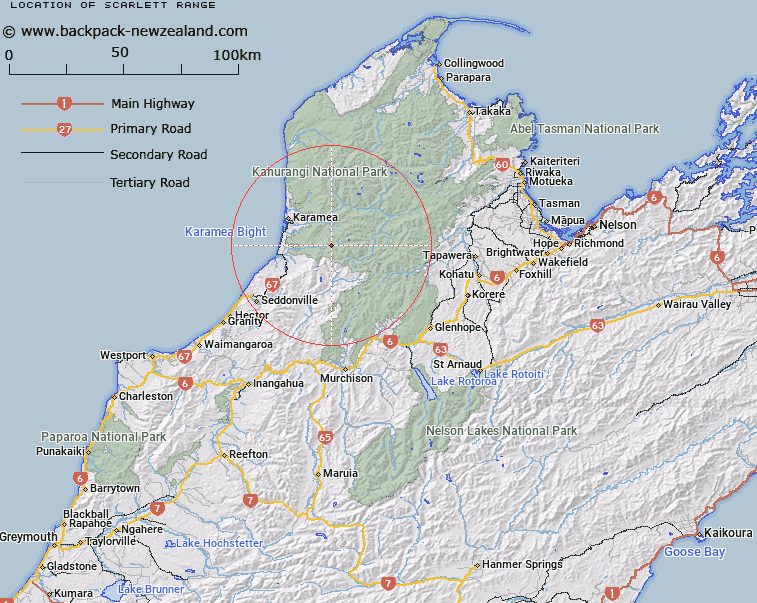
Map showing location of Scarlett Range


LINZ description: Range of peaks extending from peak Black Rat [Trig. G (Geodetic Code A6JF)], beyond Lawrence Saddle, and through Mounts Scarlett (Geodetic Code A6JG), Lester (Geodetic Code A6JW), and Brilliant to the Little Wanganui Saddle. Otumahana Survey District.
Latitude: -41.34329
Longitude: 172.271329
Northing: 5422877.3
Easting: 1539036.5
Land District: Nelson
Feat Type: Range


Scroll down to see a more detailed road map and below that a topographical map showing the location of Scarlett Range. The road map has been supplied by openstreetmap and the topographical map of Scarlett Range has been supplied by Land Information New Zealand (LINZ).

Yes you can use the top static map for you school/university project or personal website with a link back. Contact me for any commercial use.

Scarlett Range Map New Zealand


New Zealand places in our database
[ A ] [ B ] [ C ] [ D ] [ E ] [ F ] [ G ] [ H ] [ I ] [ J ] [ K ] [ L ] [ M ] [ N ] [ O ] [ P ] [ Q ] [ R ] [ S ] [ T ] [ U ] [ V ] [ W ] [ X ] [ Y ] [ Z ]


Closest 20 Ranges to Scarlett Range

Herbert Range ( 6.11km )   Radiant Range ( 13.18km )   Fenian Range ( 14.9km )   Allen Range ( 15.3km )   Morgan Range ( 25.06km )   Marshall Range ( 26.24km )   Matiri Range ( 29.38km )   Lookout Range ( 33.28km )   Wharepapa / Arthur Range ( 34.64km )   Arthur Range ( 34.64km )   Glasgow Range ( 35.2km )   Domett Range ( 35.97km )   Tasman Mountains ( 36.6km )   Peel Range ( 37.67km )   Pyramid Ridge ( 38.25km )   Gouland Range ( 40.25km )   Lyell Range ( 40.6km )   Hope Range ( 41.71km )   Lockett Range ( 41.77km )   Snowden Range ( 44.34km )   Snowdon Range ( 44.34km )   Douglas Range ( 45.11km )   Tubman Range ( 46.43km )   Pinchback Range ( 46.79km )   Iwituaroa Range ( 49.13km )   Devil Range ( 51.02km )   Braeburn Range ( 51.25km )   Slate Range ( 51.93km )   Anatoki Range ( 54.5km )   Spooners Range ( 54.78km )   Haupiri Range ( 57.91km )   Mount William Range ( 61.36km )   Brunner Range ( 61.7km )   Muntz Range ( 62.7km )   Gordon Range ( 64.03km )   Wakamarama Range ( 65.56km )   Pikikiruna Range ( 72.42km )   Pikikirunga Range ( 72.42km )   Travers Range ( 72.88km )   Victoria Range ( 75.75km )