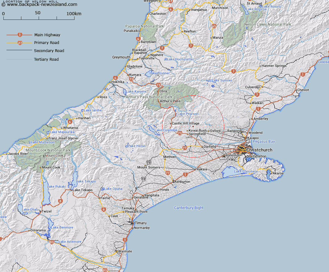
Map showing location of Wilson Hill


LINZ description: Hill in Waimakariri Gorge vicinity, east of Coal Creek, 2.75km due East of Horseshoe Bends on the Waimakariri River. 2,863 ft. Oxford Survey District.
Latitude: -43.243818
Longitude: 171.997667
Northing: 5211621.4
Easting: 1518625
Land District: Canterbury
Feat Type: Hill


Scroll down to see a more detailed road map and below that a topographical map showing the location of Wilson Hill. The road map has been supplied by openstreetmap and the topographical map of Wilson Hill has been supplied by Land Information New Zealand (LINZ).

Yes you can use the top static map for you school/university project or personal website with a link back. Contact me for any commercial use.

Wilson Hill Map New Zealand


New Zealand places in our database
[ A ] [ B ] [ C ] [ D ] [ E ] [ F ] [ G ] [ H ] [ I ] [ J ] [ K ] [ L ] [ M ] [ N ] [ O ] [ P ] [ Q ] [ R ] [ S ] [ T ] [ U ] [ V ] [ W ] [ X ] [ Y ] [ Z ]


Closest 20 Hills to Wilson Hill

Latter Hill ( 2.48km )   Fosters Hill ( 3.89km )   Windwhistle Hill ( 5km )   Paterson Hill ( 6.07km )   Patterson Hill ( 6.07km )   Black Hill ( 7.27km )   Mount Oxford ( 7.5km )   Oxford Hill ( 8.27km )   Bold Hill ( 8.74km )   View Hill ( 9.55km )   Caesars Hill ( 11.81km )   Otarama Peak ( 12.9km )   Gorge Hill ( 13.45km )   Mount Rosa ( 13.56km )   Back Peak ( 14km )   Mount Storm ( 14.08km )   Mount Torlesse ( 14.3km )   Junction Peak ( 14.55km )   Ladbrooks Hill ( 14.98km )   Nomans Land ( 15.14km )   Chest Peak ( 15.73km )   Bottle Hill ( 15.83km )   Red Peak ( 16.06km )   The Puffer ( 16.26km )   Russell Peak ( 17.75km )   Abners Head ( 17.96km )   Castle Hill Peak ( 18.53km )   Burnt Hill ( 18.84km )   Bullock Hill ( 19.03km )   Prebble Hill ( 19.49km )   Mount Richardson ( 19.55km )   Jimmys Knob ( 19.71km )   Whale Hill ( 19.76km )   Mount Saint Bernard ( 20.14km )   Broken Hill ( 20.17km )   Knowles Top ( 20.43km )   Starvation Hill ( 20.52km )   Foggy Peak ( 20.55km )   Gorge Hill ( 20.67km )   Lake Hill ( 20.85km )