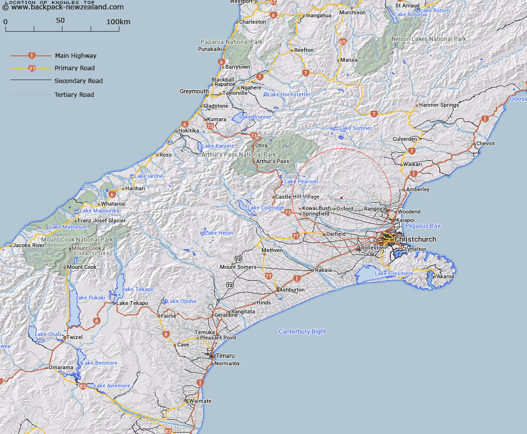
Map showing location of Knowles Top


LINZ description: Hill on the ridge running between Glentui Bush Road and Gorge Road, west of Glentui Bush
Latitude: -43.213441
Longitude: 172.246404
Northing: 5215206.8
Easting: 1538788.6
Land District: Canterbury
Feat Type: Hill


Scroll down to see a more detailed road map and below that a topographical map showing the location of Knowles Top. The road map has been supplied by openstreetmap and the topographical map of Knowles Top has been supplied by Land Information New Zealand (LINZ).

Yes you can use the top static map for you school/university project or personal website with a link back. Contact me for any commercial use.

Knowles Top Map New Zealand


New Zealand places in our database
[ A ] [ B ] [ C ] [ D ] [ E ] [ F ] [ G ] [ H ] [ I ] [ J ] [ K ] [ L ] [ M ] [ N ] [ O ] [ P ] [ Q ] [ R ] [ S ] [ T ] [ U ] [ V ] [ W ] [ X ] [ Y ] [ Z ]


Closest 20 Hills to Knowles Top

Bald Hills ( 3.07km )   Mount Richardson ( 4.14km )   Bottle Hill ( 4.6km )   Ladbrooks Hill ( 6.34km )   Starvation Hill ( 8.39km )   Ashley Hill ( 9.82km )   Mount Thomas ( 9.93km )   Oxford Hill ( 12.31km )   Mairaki Downs ( 12.44km )   Mount Oxford ( 13.06km )   Round Hill ( 13.37km )   Island Hill ( 13.51km )   Retreat Hill ( 13.59km )   Mount Storm ( 14.66km )   Okuku Hill ( 15.68km )   Pancake Hill ( 18.02km )   Spring Hill ( 19.67km )   View Hill ( 20.13km )   Wilson Hill ( 20.43km )   Burnt Hill ( 20.49km )   Black Hill ( 20.71km )   Lillburn Hill ( 21.19km )   Lilburne Hill ( 21.19km )   Mount Karetu ( 21.83km )   Fosters Hill ( 21.84km )   Mount Pember ( 22.03km )   Chest Peak ( 22.05km )   Latter Hill ( 22.66km )   Mount Gordon ( 22.99km )   Puketeraki ( 23.37km )   Gorge Hill ( 23.65km )   Windwhistle Hill ( 25.09km )   Paterson Hill ( 26.27km )   Patterson Hill ( 26.27km )   Blue Mountain ( 26.72km )   Mount Grey ( 26.74km )   Mount Grey/Maukatere ( 26.74km )   Mount Rosa ( 26.74km )   Block Hill ( 27.33km )   Devils Den ( 27.83km )