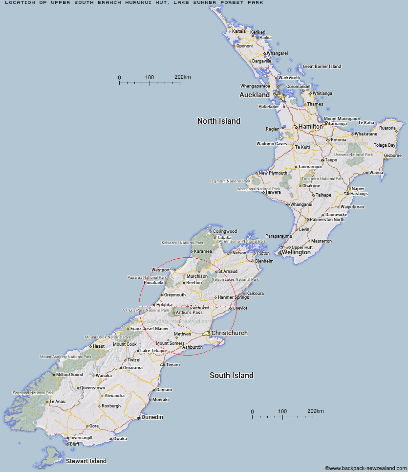
Topo Map showing location of Upper South Branch Hurunui Hut
This information is sourced from DoC, LINZ and Openstreetmap. Some of the hut photos are mine and the rest are from DoC. I will be adding an upload feature soon so people can photos of .Upper South Branch Hurunui Hut.
Basic info: basic three-bunk hut in the North Canterbury and Arthur's Pass area.
Latitude: -42.7639010215
Longitude: 171.987143995
Location: Lake Sumner Forest Park
Area: Canterbury
Type of Hut: Basic/bivvies
Map: BU22 Topo Map | Road Map
Does this hut still exist? Have any more information? Contact
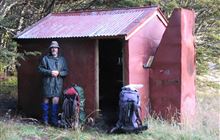
Image: DoC
Scroll down to see a topographical map and road map showing the location of Upper South Branch Hurunui Hut
[ A ] [ B ] [ C ] [ D ] [ E ] [ F ] [ G ] [ H ] [ I ] [ J ] [ K ] [ L ] [ M ] [ N ] [ O ] [ P ] [ Q ] [ R ] [ S ] [ T ] [ U ] [ V ] [ W ] [ Y ] [ Z ]
Closest 20 Huts to Upper South Branch Hurunui Hut
These are as the crow fliesCamerons Hut 6.56km Hurunui No 3 Hut 7.02km Candlesticks Bivouac 7.83km South Branch Research Hut 7.84km North Esk Hut 7.87km Harper Pass Bivouac 8.56km Stony Stream Hut 9.84km Hurunui Hut 11.13km Mid Trent Hut 11.21km Ranger Bivouac 12.6km Locke Stream Hut 13.09km Mackenzie Hut 13.11km Mackenzie Bivouac 14.36km Bull Creek Hut 14.45km Top Trent / Lagoon Hut 14.47km Lake Sumner Hut 14.49km Ant Stream Bivouac 14.54km Lake Mason Hut 14.84km Minchin Bivouac 14.84km Bush Camp Hut 14.89km Trust/Poulter Hut 15.51km Tutaekuri Hut 16.69km Ant Stream Hut 16.96km Townsend Hut 17.15km Poulter Hut 17.31km Three Mile Stream Hut 18.18km Poulter Bivouac 18.55km Elizabeth Hut 18.63km Lochinvar Hut 19.03km Deep Creek Hut 19.15km Worsley Bivouac 19.29km Waikiti Hut 19.87km Kiwi Hut 19.92km Anderson's Hut 20.62km Koropuku Hut 21.29km Anna Hut 21.56km Turnbull Bivouac 22.31km Cone Creek Hut 22.64km East Hawdon Bivouac 22.91km Esk Bivouac 24.13km