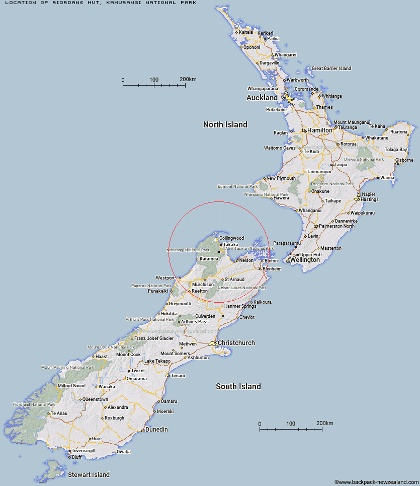
Topo Map showing location of Riordans Hut
This information is sourced from DoC, LINZ and Openstreetmap. Some of the hut photos are mine and the rest are from DoC. I will be adding an upload feature soon so people can photos of .Riordans Hut.
Basic info: basic 3-bunk hut in the Golden Bay area.
Latitude: -41.0454814985
Longitude: 172.742778725
Location: Kahurangi National Park
Area: Nelson/Tasman
Type of Hut: Basic/bivvies
Tracks: Anatoki and Historic Kill Devil Pack Tracks
Map: BP24 Topo Map | Road Map
Does this hut still exist? Have any more information? Contact
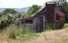
Image: DoC
Scroll down to see a topographical map and road map showing the location of Riordans Hut
[ A ] [ B ] [ C ] [ D ] [ E ] [ F ] [ G ] [ H ] [ I ] [ J ] [ K ] [ L ] [ M ] [ N ] [ O ] [ P ] [ Q ] [ R ] [ S ] [ T ] [ U ] [ V ] [ W ] [ Y ] [ Z ]
Closest 20 Huts to Riordans Hut
These are as the crow fliesRiordans Hut 0km Tin Hut Shelter 3.68km Waingaro Forks Hut 5.75km Asbestos Cottage 10.29km Sylvester Hut 10.65km Soper Shelter 13km Myttons Hut 14.28km Upper Gridiron Hut and Rock Shelters 14.44km Trilobite Hut 14.64km Growler Rock Shelter 14.66km Flora Hut 15.29km Chaffey Hut 15.43km Dry Rock Shelter 16.25km Anatoki Forks Hut 16.34km Lonely Lake Hut 17.01km Balloon Hut 17.05km Mt Arthur Hut 17.08km Tent Camp 17.46km Fenella Hut 18.25km Cobb Hut 18.29km Castle Rock Hut 20.01km Moa Park Shelter 20.13km Adelaide Tarn Hut 20.27km Wainui Hut 20.85km Splugeons Rock Shelter 21.03km Boulder Lake Hut 21.24km Ellis Hut 21.91km Holyoake Clearing Shelter 23.54km Awapoto Hut 26.15km Flanagans Hut 28.18km Anchorage Hut 28.2km Karamea Bend Hut 28.49km Bark Bay Hut 29.43km Awaroa Hut 30.56km Roaring Lion Hut 30.95km Perry Saddle Hut 32.74km Brown Hut 32.96km Whariwharangi Hut 34.52km Crow Hut 35.87km Gouland Downs Hut 36.96km