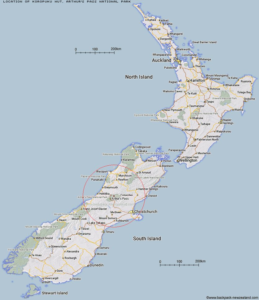
Topo Map showing location of Koropuku Hut
This information is sourced from DoC, LINZ and Openstreetmap. Some of the hut photos are mine and the rest are from DoC. I will be adding an upload feature soon so people can photos of .Koropuku Hut.
Basic info: basic four-bunk hut in the Hokitika area.
Latitude: -42.811975268
Longitude: 171.734603269
Location: Arthur's Pass National Park
Area: West Coast
Type of Hut: Basic/bivvies
Map: BV21 Topo Map | Road Map
Does this hut still exist? Have any more information? Contact
Basic info: basic four-bunk hut in the Hokitika area.
Latitude: -42.811975268
Longitude: 171.734603269
Location: Arthur's Pass National Park
Area: West Coast
Type of Hut: Basic/bivvies
Map: BV21 Topo Map | Road Map
Does this hut still exist? Have any more information? Contact
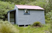
Image: DoC
Scroll down to see a topographical map and road map showing the location of Koropuku Hut
[ A ] [ B ] [ C ] [ D ] [ E ] [ F ] [ G ] [ H ] [ I ] [ J ] [ K ] [ L ] [ M ] [ N ] [ O ] [ P ] [ Q ] [ R ] [ S ] [ T ] [ U ] [ V ] [ W ] [ Y ] [ Z ]
Closest 20 Huts to Koropuku Hut
These are as the crow fliesPoulter Bivouac 2.98km Otehake Hut 5.43km Townsend Hut 5.46km Pfeifer Bivouac 5.73km Worsley Bivouac 5.91km Kiwi Hut 6.16km Minchin Bivouac 6.46km Poulter Hut 7.42km Trust/Poulter Hut 10.02km East Hawdon Bivouac 10.35km Hawdon Hut 11.03km Locke Stream Hut 11.19km Top Crooked Hut 12.48km Upper Deception Hut 12.5km Goat Pass Hut 13.39km Ranger Bivouac 14.06km Elizabeth Hut 14.31km Jacko Flat Hut 14.34km Cone Creek Hut 14.41km Top Trent / Lagoon Hut 14.84km Mingha Bivouac 14.98km Carroll Hut 15.08km Sudden Valley Bivouac 15.5km Edwards Hut 16.07km Harper Pass Bivouac 16.38km Lake Morgan Hut 16.65km Camp Creek Hut 18.41km Jacks Hut 18.66km Mid Trent Hut 18.85km Hunts Creek Hut 19.27km Hawdon Shelter 19.56km Dillon Hut 20.41km Dillons Homestead Hut 20.61km Andrews Shelter 20.79km Camerons Hut 21.02km Bull Creek Hut 21.08km Riversdale Hut 21.24km Upper South Branch Hurunui Hut 21.29km Turnbull Bivouac 21.39km Greyneys Shelter 22.48km