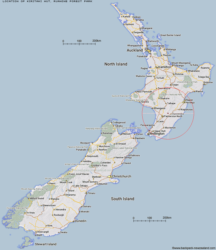
Topo Map showing location of Kiritaki Hut
This information is sourced from DoC, LINZ and Openstreetmap. Some of the hut photos are mine and the rest are from DoC. I will be adding an upload feature soon so people can photos of .Kiritaki Hut.
Basic info: standard six-bunk hut in the Hawke's Bay region.
Latitude: -40.1886098198
Longitude: 175.919735309
Location: Ruahine Forest Park
Area: Hawke's Bay
Type of Hut: Standard
Tracks: Kumeti Road End tramping tracks
Map: BM35 Topo Map | Road Map
Does this hut still exist? Have any more information? Contact
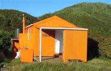
Image: DoC
Scroll down to see a topographical map and road map showing the location of Kiritaki Hut
[ A ] [ B ] [ C ] [ D ] [ E ] [ F ] [ G ] [ H ] [ I ] [ J ] [ K ] [ L ] [ M ] [ N ] [ O ] [ P ] [ Q ] [ R ] [ S ] [ T ] [ U ] [ V ] [ W ] [ Y ] [ Z ]
Closest 20 Huts to Kiritaki Hut
These are as the crow fliesKiritaki Hut 0km Forks Hut 8.48km Te Ekaou Hut 8.8km Diggers Hut 10.22km Traverse (A Frame) Hut 12.09km Stanfield Hut 15.64km Mid Pohangina Hut 17.9km Cattle Creek Hut 18.33km Piripiri Hut 18.56km Ngamoko Hut 20.46km Leon Kinvig Hut 24.45km Toka Bivouac 26.28km Makaretu Hut 26.56km Alice Nash Memorial Heritage Lodge 27.3km Happy Daze Hut 28.45km Top Gorge Hut 29.2km Awatere Hut 30.55km Iron Gate Hut 31.36km Longview Hut 31.51km Rangiwahia Hut 34.16km Triangle Hut 34.27km Daphne Hut 36.1km Howletts Hut 36.17km Tarn Bivouac 38.93km Pourangaki Hut 39.17km Kelly Knight Hut 39.31km Hinerua Hut 42.11km Purity Hut 42.58km Waterfall Hut 43.28km Smiths Stream Hut 43.36km Waikamaka Hut 45.72km North Mangahao Bivouac 47.42km McKinnon Hut 47.65km Waipawa Forks Hut 48.51km Kawhatau Base 48.78km Crow Hut 48.96km Sunrise Hut 49.36km Triplex Hut 49.94km Top Maropea Hut 50.33km Wakelings Hut 51.47km