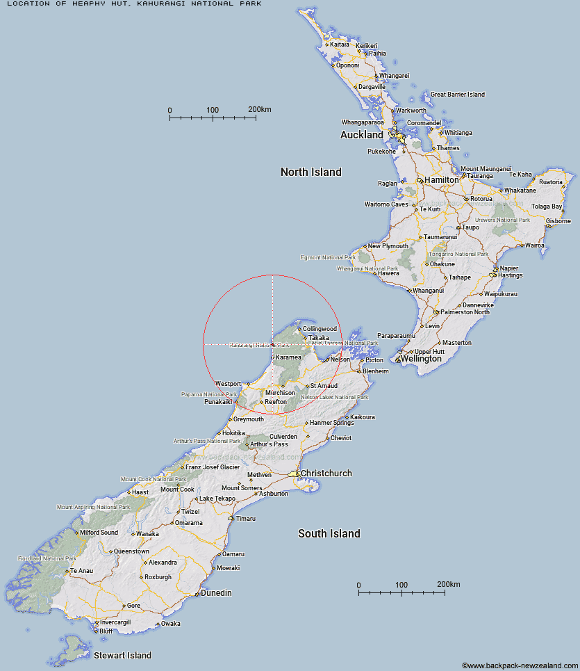
Topo Map showing location of Heaphy Hut
This information is sourced from DoC, LINZ and Openstreetmap. Some of the hut photos are mine and the rest are from DoC. I will be adding an upload feature soon so people can photos of .Heaphy Hut.
Basic info: 32 -bunk hut located on the Heaphy Track in the Buller area.
Latitude: -40.9866787631
Longitude: 172.110673068
Location: Kahurangi National Park
Area: Nelson/Tasman
Type of Hut: Great Walk
Tracks: Heaphy Track
Map: BP22 Topo Map | Road Map
Does this hut still exist? Have any more information? Contact
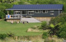
Image: DoC
Scroll down to see a topographical map and road map showing the location of Heaphy Hut
[ A ] [ B ] [ C ] [ D ] [ E ] [ F ] [ G ] [ H ] [ I ] [ J ] [ K ] [ L ] [ M ] [ N ] [ O ] [ P ] [ Q ] [ R ] [ S ] [ T ] [ U ] [ V ] [ W ] [ Y ] [ Z ]
Closest 20 Huts to Heaphy Hut
These are as the crow fliesLewis Hut 6.06km Katipo Creek Shelter 6.41km Kohaihai Shelter 13.62km James Mackay Hut 14.31km Ministry of Works Historic Hut 19.39km Saxon Hut 20km Sunshine Flat Shelter 21.99km Gouland Downs Hut 23.01km Adams Flat Hut 24.95km Perry Saddle Hut 26.32km Greys Hut 31.29km Brown Hut 32.09km Fenella Hut 35.47km Cobb Hut 35.61km Roaring Lion Hut 35.84km Adelaide Tarn Hut 36.67km Tent Camp 36.79km Lonely Lake Hut 37.55km Chaffey Hut 40.42km Boulder Lake Hut 40.49km Soper Shelter 40.86km Kākāpō Hut 41.71km Belltown Manunui Hut 41.74km Anatoki Forks Hut 42.11km Karamea Bend Hut 43.31km Trilobite Hut 44.74km Crow Hut 45.42km Wangapeka Bivouac 45.87km Venus Hut 45.89km Myttons Hut 45.94km Sylvester Hut 46.68km Balloon Hut 47.45km Waingaro Forks Hut 47.73km Stag Flat Shelter 48.12km Splugeons Rock Shelter 48.29km Taipo Hut 48.78km Thor Hut 49.08km Dry Rock Shelter 50.72km Flanagans Hut 51.23km Asbestos Cottage 51.26km