Topo Map showing location of Healey Creek Hut
This information is sourced from DoC, LINZ and Openstreetmap. Some of the hut photos are mine and the rest are from DoC. I will be adding an upload feature soon so people can photos of .Healey Creek Hut.
Basic info: basic four-bunk hut in the Hokitika area.
Latitude: -43.0502150678
Longitude: 170.911118965
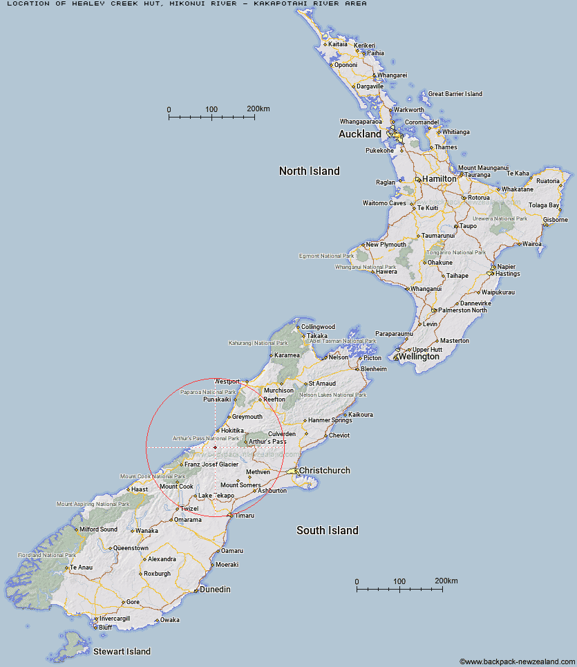
Location: Mikonui River - Kakapotahi River area
Area: West Coast
Type of Hut: Basic/bivvies
Map: BV18 Topo Map | Road Map
Does this hut still exist? Have any more information? Contact
Basic info: basic four-bunk hut in the Hokitika area.
Latitude: -43.0502150678
Longitude: 170.911118965
Location: Mikonui River - Kakapotahi River area
Area: West Coast
Type of Hut: Basic/bivvies
Map: BV18 Topo Map | Road Map
Does this hut still exist? Have any more information? Contact
Scroll down to see a topographical map and road map showing the location of Healey Creek Hut
[ A ] [ B ] [ C ] [ D ] [ E ] [ F ] [ G ] [ H ] [ I ] [ J ] [ K ] [ L ] [ M ] [ N ] [ O ] [ P ] [ Q ] [ R ] [ S ] [ T ] [ U ] [ V ] [ W ] [ Y ] [ Z ]
Closest 20 Huts to Healey Creek Hut
These are as the crow fliesMikonui Spur Bivouac 3.11km Dickie Spur Hut 3.51km Mikonui Flat Hut 4.2km Top Tuke Hut 4.74km Explorer Hut 5.53km Polluck Creek Hut 7.4km Rapid Creek Hut 9.19km Top Waitaha Hut 9.45km Ivory Lake Hut 9.47km Black Hut 9.65km Price Basin Hut 9.94km Price Flat Hut 10.06km Price Flat Hut 10.27km Frew Hut 10.75km County Stream Hut 12.99km Moonbeam Hut 13.07km Wilkinson Hut 13.46km Serpentine Hut 14.27km Frew Saddle Bivouac 14.97km Neave Hut 15.61km Frisco Hut 16.37km Kiwi Flat Hut 16.39km Gerhardt Spur Bivouac 17.33km Bluff Hut 17.54km Scamper Torrent Hut 18.2km Mullins Hut 18.25km Smyth Hut 18.36km West Mathias Bivouac 19.43km Poet Hut 19.67km Sir Robert Hut 19.86km Top Toaroha Hut 20.15km Crystal Bivouac 20.53km Yeats Ridge Hut 20.67km Canyon Creek Bivouac 20.79km Toaroha Saddle Bivouac 20.82km Cedar Flat Hut 21.29km Adventure Bivouac 22.45km Centennial Cabin 22.67km Mungo Hut 23.41km Mathias Hut 23.48km