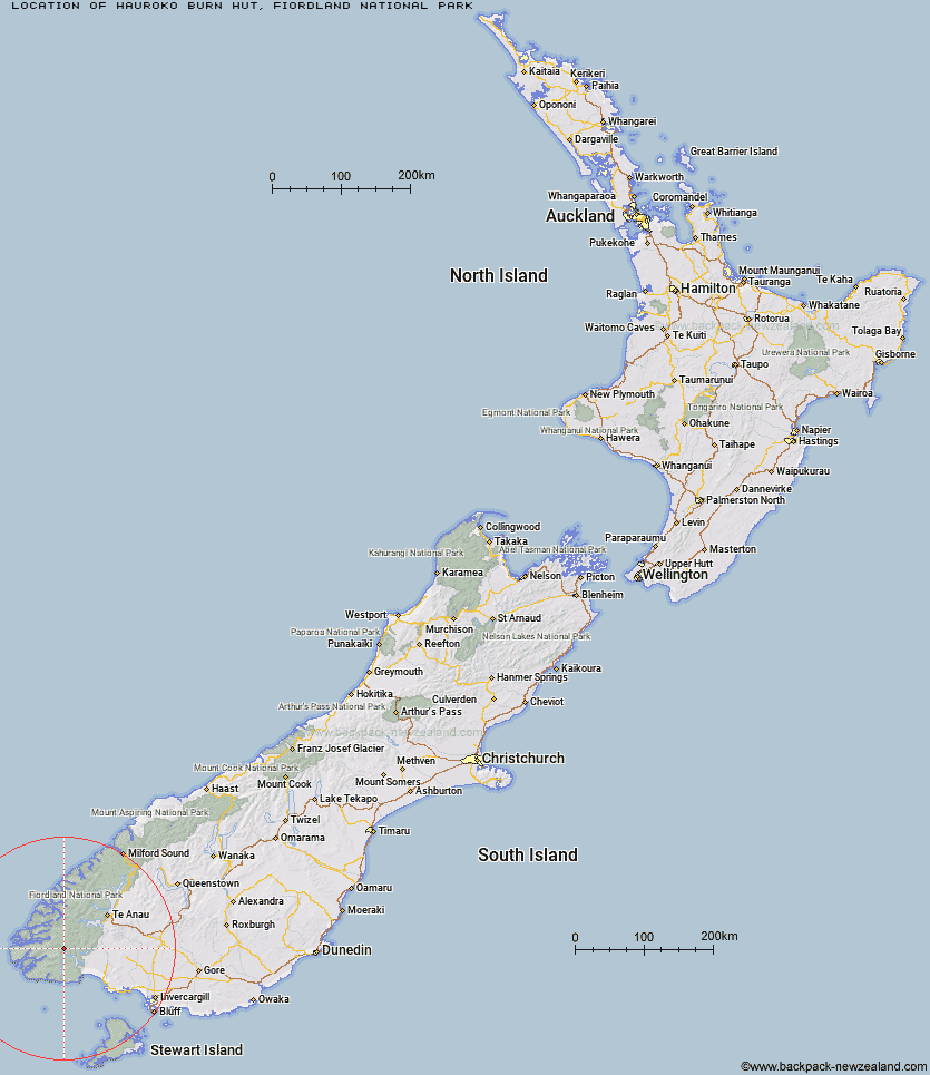
Topo Map showing location of Hauroko Burn Hut
This information is sourced from DoC, LINZ and Openstreetmap. Some of the hut photos are mine and the rest are from DoC. I will be adding an upload feature soon so people can photos of .Hauroko Burn Hut.
Basic info: standard 10-bunk hut in western Fiordland.
Latitude: -45.8306475191
Longitude: 167.145486764
Location: Fiordland National Park
Area: Fiordland
Type of Hut: Standard
Tracks: Dusky Track
Map: CE06 Topo Map | Road Map
Does this hut still exist? Have any more information? Contact
Basic info: standard 10-bunk hut in western Fiordland.
Latitude: -45.8306475191
Longitude: 167.145486764
Location: Fiordland National Park
Area: Fiordland
Type of Hut: Standard
Tracks: Dusky Track
Map: CE06 Topo Map | Road Map
Does this hut still exist? Have any more information? Contact
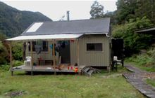
Image: DoC
Scroll down to see a topographical map and road map showing the location of Hauroko Burn Hut
[ A ] [ B ] [ C ] [ D ] [ E ] [ F ] [ G ] [ H ] [ I ] [ J ] [ K ] [ L ] [ M ] [ N ] [ O ] [ P ] [ Q ] [ R ] [ S ] [ T ] [ U ] [ V ] [ W ] [ Y ] [ Z ]
Closest 20 Huts to Hauroko Burn Hut
These are as the crow fliesHalfway Hut 7.88km Lake Roe Hut 14.13km Historic Clark Hut 14.36km Clark Hut - A Frame 15.02km Monowai Hut 15.8km Caroline Hut 16.29km Loch Maree Hut 17.35km Eel Creek Hut 17.69km Borland Bivouac 20.21km Green Lake Hut 20.36km Supper Cove Hut 21.14km Rodger Inlet Huts 23.25km Kintail Hut 24.13km Upper Spey Hut 27.87km Teal Bay Hut 28.66km Percy Shelter 30.2km North Borland Hut 30.94km Lake Poteriteri Hut 31.16km West Arm Hut 35.14km Okaka Lodge 38.68km Slaughterburn Hut 40.67km Hope Arm Hut 40.76km Back Valley Hut 42.44km Waitutu Hut 45.64km Westies Hut 46.33km Port Craig Lodge 46.6km Port Craig School Hut 46.66km Freeman Burn Hut 47.1km Percy Burn Hut 47.31km Wairaurahiri Hut 47.39km Te Oneroa Hut 48.86km Shallow Bay Hut 52.19km Moturau Hut 53.03km Redcliff Hut 54.25km Cheviot Downs Hut 54.37km Telford Hut 55.01km Barcoo Hut 55.26km Iris Burn Hut 55.72km Whare Creek Hut 55.83km Rock Hut 57.45km