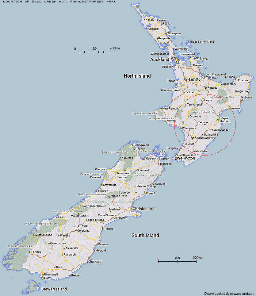
Topo Map showing location of Gold Creek Hut
This information is sourced from DoC, LINZ and Openstreetmap. Some of the hut photos are mine and the rest are from DoC. I will be adding an upload feature soon so people can photos of .Gold Creek Hut.
Basic info: basic four-bunk hut in the Hawke's Bay region.
Latitude: -39.7618260572
Longitude: 176.197173883
Location: Ruahine Forest Park
Area: Manawatu/Whanganui
Type of Hut: Basic/bivvies
Tracks: Wakarara Road End routes
Map: BK36 Topo Map | Road Map
Does this hut still exist? Have any more information? Contact
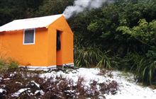
Image: DoC
Scroll down to see a topographical map and road map showing the location of Gold Creek Hut
[ A ] [ B ] [ C ] [ D ] [ E ] [ F ] [ G ] [ H ] [ I ] [ J ] [ K ] [ L ] [ M ] [ N ] [ O ] [ P ] [ Q ] [ R ] [ S ] [ T ] [ U ] [ V ] [ W ] [ Y ] [ Z ]
Closest 20 Huts to Gold Creek Hut
These are as the crow fliesGold Creek Hut 0km Sparrowhawk Bivouac 3.06km Triplex Hut 3.51km Top Maropea Hut 3.62km Norris Hut 3.63km Sunrise Hut 3.79km Waipawa Forks Hut 4.51km Barlow Hut 5.42km Wakelings Hut 5.82km Maropea Forks Hut 6.15km Waikamaka Hut 7.74km Ellis Hut 8.97km McKinnon Hut 9.03km Kylie Bivouac 9.13km Upper Makaroro Hut 9.47km Crow Hut 9.59km Smiths Stream Hut 9.98km Waterfall Hut 10.3km Parks Peak Hut 10.42km Poutaki Hut 10.73km Colenso Hut 11.14km Hinerua Hut 11.36km Otukota Hut 11.49km Sentry Box Hut 12.6km Iron Bark Hut 12.62km Kawhatau Base 13.2km Tin Hut 13.28km Purity Hut 13.68km Tarn Bivouac 14.28km Pourangaki Hut 14.65km Ruahine Corner Hut 14.68km Aranga Hut 14.97km Kelly Knight Hut 15.74km Briens Hut 16.25km Rockslide Hut 16.49km Howletts Hut 16.96km Daphne Hut 17.42km Mistake Bivouac 17.46km Masters Shelter 18.23km Triangle Hut 18.95km