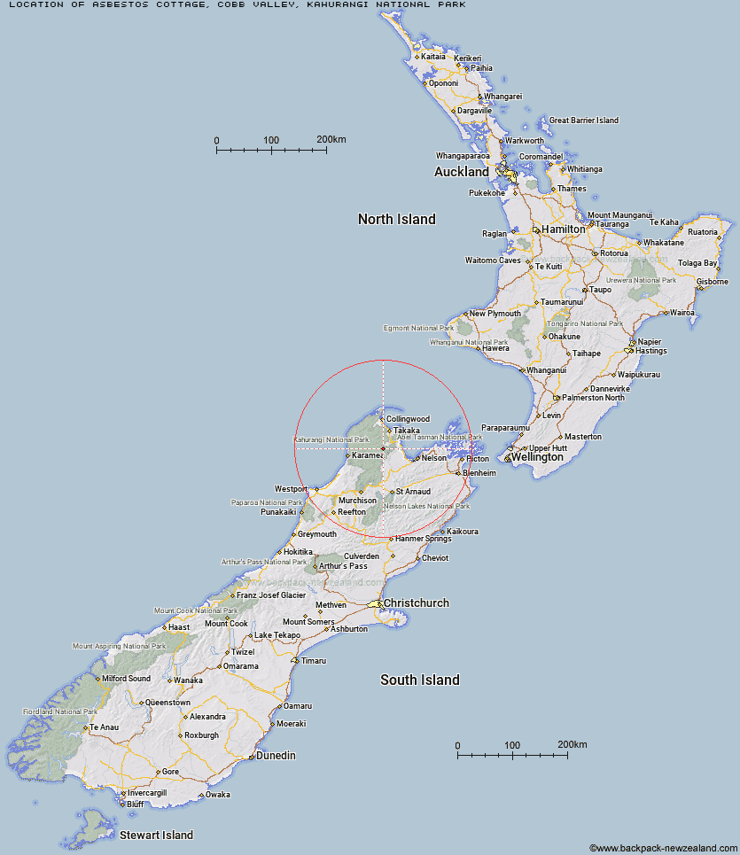
Topo Map showing location of Asbestos Cottage
This information is sourced from DoC, LINZ and Openstreetmap. Some of the hut photos are mine and the rest are from DoC. I will be adding an upload feature soon so people can photos of .Asbestos Cottage.
Basic info: Built in 1897, Asbestos Cottage had remedial work completed in 1997. It is available as accommodation for trampers in Kahurangi National Park.
Latitude: -41.1296887494
Longitude: 172.691920333
Location: Cobb Valley, Kahurangi National Park
Area: Nelson/Tasman
Type of Hut: Basic/bivvies
Tracks: Asbestos Cottage tracks
Map: BP24 Topo Map | Road Map
Does this hut still exist? Have any more information? Contact
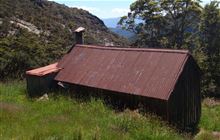
Image: DoC
Scroll down to see a topographical map and road map showing the location of Asbestos Cottage
[ A ] [ B ] [ C ] [ D ] [ E ] [ F ] [ G ] [ H ] [ I ] [ J ] [ K ] [ L ] [ M ] [ N ] [ O ] [ P ] [ Q ] [ R ] [ S ] [ T ] [ U ] [ V ] [ W ] [ Y ] [ Z ]
Closest 20 Huts to Asbestos Cottage
These are as the crow fliesGrowler Rock Shelter 4.38km Upper Gridiron Hut and Rock Shelters 4.57km Sylvester Hut 4.78km Myttons Hut 5.92km Dry Rock Shelter 5.96km Flora Hut 6.7km Trilobite Hut 6.93km Balloon Hut 7.28km Mt Arthur Hut 7.82km Waingaro Forks Hut 9.47km Riordans Hut 10.29km Chaffey Hut 10.87km Splugeons Rock Shelter 10.93km Ellis Hut 12.03km Tin Hut Shelter 13.96km Tent Camp 14.83km Soper Shelter 15.87km Cobb Hut 16.21km Fenella Hut 16.57km Flanagans Hut 17.91km Karamea Bend Hut 19.01km Lonely Lake Hut 19.84km Anatoki Forks Hut 22.31km Roaring Lion Hut 22.91km Adelaide Tarn Hut 24.24km Crow Hut 26.08km Boulder Lake Hut 27.25km Castle Rock Hut 28.83km Moa Park Shelter 29.54km Venus Hut 29.65km Wainui Hut 30.67km Holyoake Clearing Shelter 31.84km John Reid Hut 32.55km Thor Hut 32.68km Kiwi Saddle Hut 34.97km Perry Saddle Hut 35.13km Awapoto Hut 36.19km Anchorage Hut 36.2km Greys Hut 36.89km Brown Hut 37.23km