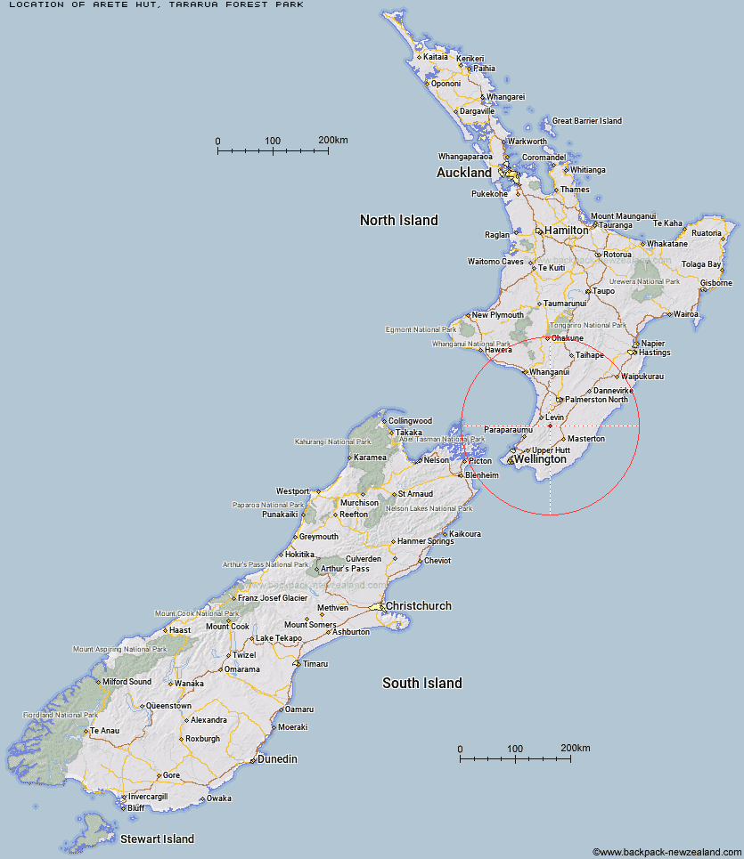
Topo Map showing location of Arete Hut
This information is sourced from DoC, LINZ and Openstreetmap. Some of the hut photos are mine and the rest are from DoC. I will be adding an upload feature soon so people can photos of .Arete Hut.
Basic info: basic two-bunk hut in the Wairarapa region.
Latitude: -40.7485464629
Longitude: 175.437014816
Location: Tararua Forest Park
Area: Wairarapa
Type of Hut: Basic/bivvies
Tracks: Tararua Northern Crossing
Map: BN34 Topo Map | Road Map
Does this hut still exist? Have any more information? Contact
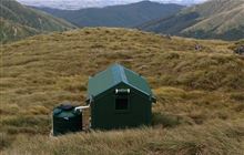
Image: DoC
Scroll down to see a topographical map and road map showing the location of Arete Hut
[ A ] [ B ] [ C ] [ D ] [ E ] [ F ] [ G ] [ H ] [ I ] [ J ] [ K ] [ L ] [ M ] [ N ] [ O ] [ P ] [ Q ] [ R ] [ S ] [ T ] [ U ] [ V ] [ W ] [ Y ] [ Z ]
Closest 20 Huts to Arete Hut
These are as the crow fliesArete Hut 0km Arete Forks Hut 2.42km Te Matawai Hut 3.45km Dundas Hut 4.32km Dracophyllum Hut 4.64km Tarn Ridge Hut 4.7km South Ohau Hut 5.23km Cow Creek Hut 5.53km Carkeek Hut 5.76km Cattle Ridge Hut 5.97km Mangahao Flats Hut 6.31km North Ohau Hut 6.43km Dorset Ridge Hut 6.68km Waiopehu Hut 7.18km Roaring Stag Hut 7.64km Blue Range Hut 8.49km Nichols Hut 8.57km Mid King Bivouac 8.82km Herepai Hut 9.59km McGregor Bivouac 9.61km Mitre Flats Hut 9.77km Jumbo Hut 11.77km Anderson Memorial Hut 12.85km Atiwhakatu Hut 13.38km Waitewaewae Hut 14.33km Mid Waiohine Hut 14.71km Powell Hut 15.19km Burn Hut 16.21km Mountain House Shelter 16.25km Waikawa Shelter 16.3km Aokaparangi Hut 17.19km Maungahuka Hut 20.16km Totara Flats Hut 20.67km Penn Creek Hut 21.22km Neill Forks Hut 21.58km Sayer Hut 22.3km Field Hut 23.35km Kime Hut 25.69km North Mangahao Bivouac 27.05km Cone Hut 27.65km