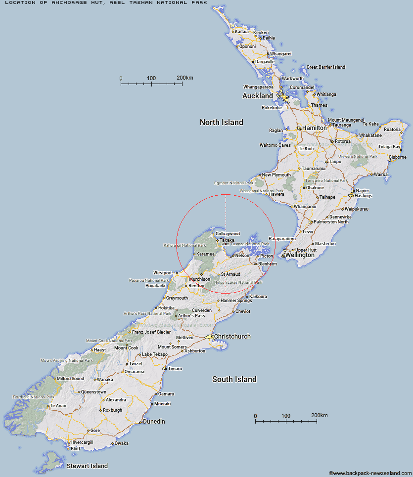
Topo Map showing location of Anchorage Hut
This information is sourced from DoC, LINZ and Openstreetmap. Some of the hut photos are mine and the rest are from DoC. I will be adding an upload feature soon so people can photos of .Anchorage Hut.
Basic info: 34-bunk hut located on the Abel Tasman Coast Track in the Motueka area.
Latitude: -40.9568700326
Longitude: 173.05767467
Location: Abel Tasman National Park
Area: Nelson/Tasman
Type of Hut: Great Walk
Tracks: Abel Tasman Coast Track
Map: BP25 Topo Map | Road Map
Does this hut still exist? Have any more information? Contact
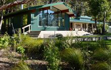
Image: DoC
Scroll down to see a topographical map and road map showing the location of Anchorage Hut
[ A ] [ B ] [ C ] [ D ] [ E ] [ F ] [ G ] [ H ] [ I ] [ J ] [ K ] [ L ] [ M ] [ N ] [ O ] [ P ] [ Q ] [ R ] [ S ] [ T ] [ U ] [ V ] [ W ] [ Y ] [ Z ]
Closest 20 Huts to Anchorage Hut
These are as the crow fliesBark Bay Hut 4.59km Holyoake Clearing Shelter 4.77km Castle Rock Hut 8.74km Moa Park Shelter 10.42km Awaroa Hut 10.73km Wainui Hut 12.47km Awapoto Hut 14.46km Whariwharangi Hut 19.94km Tin Hut Shelter 25.83km Riordans Hut 28.2km Waingaro Forks Hut 33.66km Asbestos Cottage 36.2km Flora Hut 37.21km Anatoki Forks Hut 37.79km Sylvester Hut 38.44km Upper Gridiron Hut and Rock Shelters 38.49km Soper Shelter 39.07km Mt Arthur Hut 39.23km Growler Rock Shelter 39.7km Boulder Lake Hut 40.72km Dry Rock Shelter 41.39km Myttons Hut 41.63km Lonely Lake Hut 42.05km Trilobite Hut 42.27km Adelaide Tarn Hut 43.22km Balloon Hut 43.46km Chaffey Hut 43.63km Ellis Hut 44.12km Tent Camp 45.39km Fenella Hut 45.86km Cobb Hut 46.03km Third House Shelter 46.67km Splugeons Rock Shelter 46.69km Dun Shelter 50.48km Rocks Hut 51.99km Flanagans Hut 52.47km Brown Hut 52.65km Hacket Hut 53.41km Browning Hut 54.01km Karamea Bend Hut 55.15km