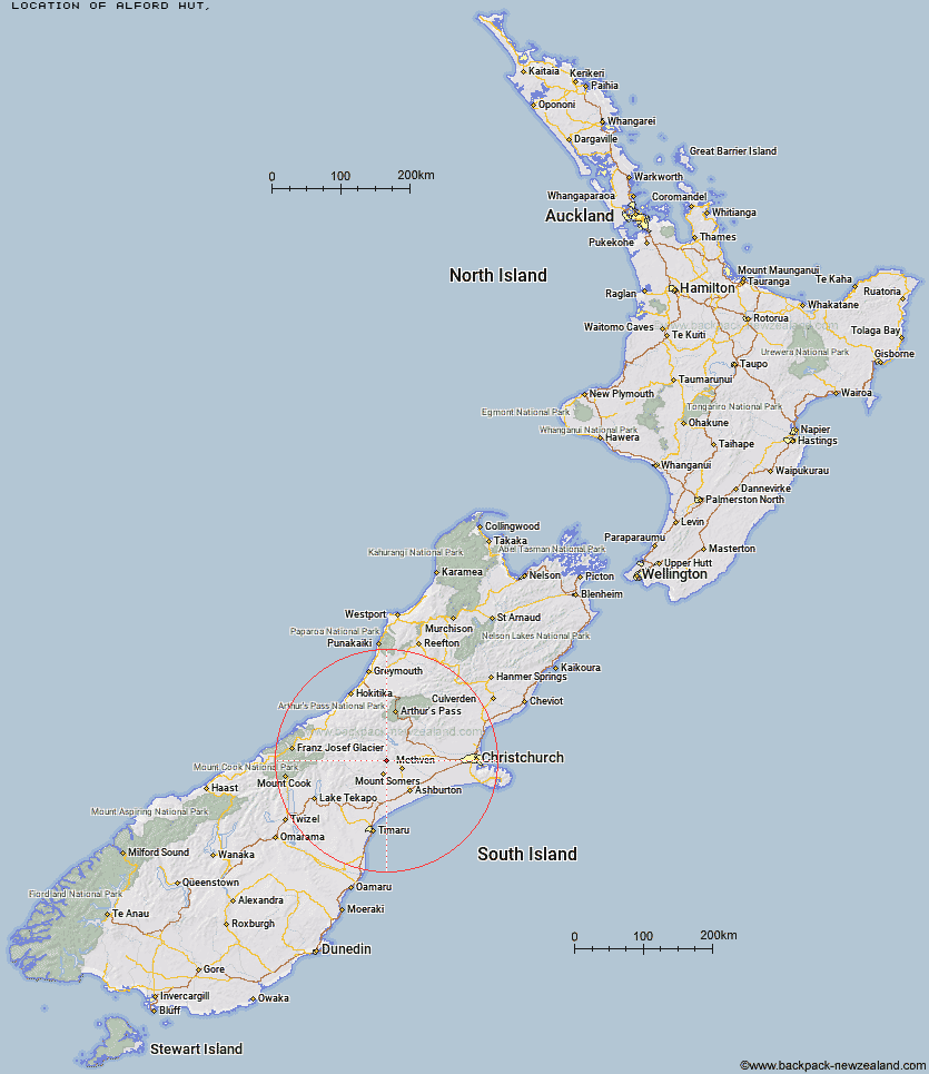
Topo Map showing location of Alford Hut
This information is sourced from DoC, LINZ and Openstreetmap. Some of the hut photos are mine and the rest are from DoC. I will be adding an upload feature soon so people can photos of .Alford Hut.
Latitude: -43.5454786627
Longitude: 171.437009228
Location:
Type of Hut:
Map: Topo Map | Road Map
Does this hut still exist? Have any more information? Contact
Latitude: -43.5454786627
Longitude: 171.437009228
Location:
Type of Hut:
Map: Topo Map | Road Map
Does this hut still exist? Have any more information? Contact
Scroll down to see a topographical map and road map showing the location of Alford Hut
[ A ] [ B ] [ C ] [ D ] [ E ] [ F ] [ G ] [ H ] [ I ] [ J ] [ K ] [ L ] [ M ] [ N ] [ O ] [ P ] [ Q ] [ R ] [ S ] [ T ] [ U ] [ V ] [ W ] [ Y ] [ Z ]
Closest 20 Huts to Alford Hut
These are as the crow fliesCookshop Hut 2.94km Cutty Grass Hut 3.03km Lagoon Hut 4.89km Three Creeks Hut 6.38km Cookies Hut 6.69km Pinnacles Hut 8.41km Tribulation Hut 10.17km Woolshed Creek Hut 10.89km Comyns Hut 14.15km Manuka Hut 14.76km Double Hut 15.25km A Frame Hut 18.86km Charlies Hut 27.83km Boundary Creek Hut 29.52km Benmore Hut 32.4km Highland Home 32.76km Downs Hut 34.59km Top Hut 35.73km Potts Hut 38.09km Thompsons Hut 38.56km Top Mount Peel Huts 39.06km Cameron Hut 39.2km Jellicoe Hut 39.26km Banfield Hut 41.25km Manuels Hut 41.64km Bottom Mount Peel Hut 42.3km Taffy Hut 42.34km Washbourne Hut 45.08km Ribbonwood Hut 45.42km Hermitage Hut 45.58km Evans Hut 45.68km Lawrence Hut 46.63km Fanghill Hut 46.76km Mathias Hut 46.89km Lawrence Bivouac 47.12km Moraine Hut 47.13km Centennial Cabin 47.7km Reischek Hut 48.29km Moa Stream Hut 48.44km Erewhon Station Hut 48.7km