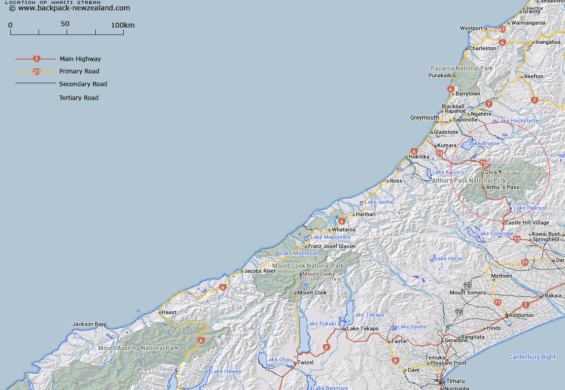
Map showing location of Whaiti Stream


LINZ description: Left bank tributary of Otehake River rising on the eastern slopes of Mount Tarapuhi, flowing eastward, and joining Otehake River 1.5km downstream of Koropuku Creek. Block XII, Otira Survey District.
Latitude: -42.822218
Longitude: 171.693845
Northing: 5258100
Easting: 1493230.3
Land District: Westland
Feat Type: Stream


Scroll down to see a more detailed road map and below that a topographical map showing the location of Whaiti Stream. The road map has been supplied by openstreetmap and the topographical map of Whaiti Stream has been supplied by Land Information New Zealand (LINZ).

Yes you can use the top static map for you school/university project or personal website with a link back. Contact me for any commercial use.

Whaiti Stream Map New Zealand


New Zealand places in our database
[ A ] [ B ] [ C ] [ D ] [ E ] [ F ] [ G ] [ H ] [ I ] [ J ] [ K ] [ L ] [ M ] [ N ] [ O ] [ P ] [ Q ] [ R ] [ S ] [ T ] [ U ] [ V ] [ W ] [ X ] [ Y ] [ Z ]


Closest 20 Streams to Whaiti Stream

Koropuku Creek ( 2.82km )   Otehake River ( 3.3km )   Tawhana Stream ( 3.57km )   Spray Creek ( 4.49km )   Otehake River West Branch ( 4.6km )   Pfeifer Creek ( 4.85km )   Lake Creek ( 5km )   Tutu Creek ( 5.03km )   Midday Creek ( 5.03km )   Chasm Stream ( 5.28km )   Foggy Creek ( 6.05km )   Deception River ( 6.11km )   Gorge Creek ( 6.53km )   Poulter River ( 6.6km )   Twin Slip Creeks ( 6.61km )   Otehake River East Branch ( 6.69km )   Paratu Stream ( 6.72km )   Enchanted Stream ( 6.81km )   Clear Creek ( 7.38km )   Shaffrey Creek ( 8.05km )   Jacksons Creek ( 8.15km )   Good Luck Creek ( 8.4km )   Trudge Stream ( 8.48km )   Linwood Creek ( 9.19km )   Twin Fall Stream ( 9.29km )   Dorreen Creek ( 9.38km )   Doreen Creek ( 9.38km )   Minchin Stream ( 9.44km )   Barrack Creek ( 10.32km )   Alexander Creek ( 10.59km )   Rocky Creek ( 10.7km )   Discovery Stream ( 10.77km )   Taverners Creek ( 10.91km )   Toms Creek ( 11.08km )   Townsend Creek ( 11.4km )   Wesley Creek ( 12.1km )   Joseph Creek ( 12.37km )   Nellies Creek ( 12.44km )   Hut Creek ( 12.49km )   Goat Creek ( 12.56km )