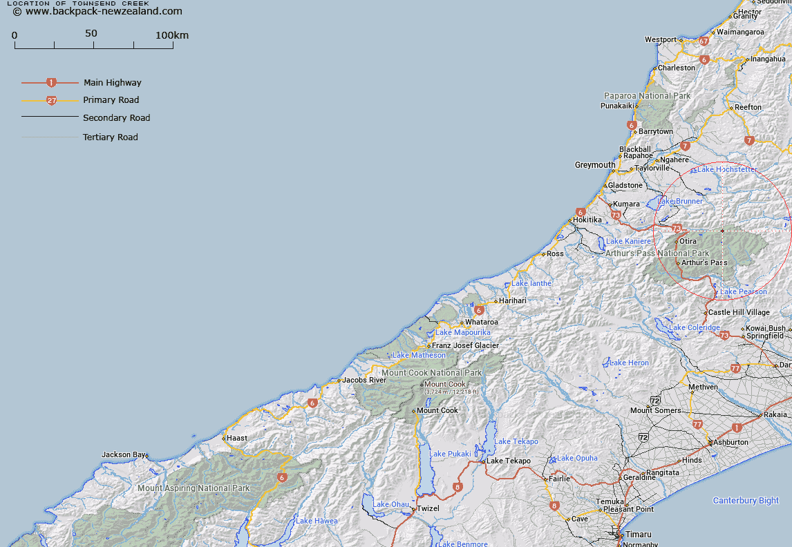
Map showing location of Townsend Creek


LINZ description: Arising near Minchin Pass
Latitude: -42.770398
Longitude: 171.81435
Northing: 5264000
Easting: 1503000
Land District: Westland
Feat Type: Stream


Scroll down to see a more detailed road map and below that a topographical map showing the location of Townsend Creek. The road map has been supplied by openstreetmap and the topographical map of Townsend Creek has been supplied by Land Information New Zealand (LINZ).

Yes you can use the top static map for you school/university project or personal website with a link back. Contact me for any commercial use.

Townsend Creek Map New Zealand


New Zealand places in our database
[ A ] [ B ] [ C ] [ D ] [ E ] [ F ] [ G ] [ H ] [ I ] [ J ] [ K ] [ L ] [ M ] [ N ] [ O ] [ P ] [ Q ] [ R ] [ S ] [ T ] [ U ] [ V ] [ W ] [ X ] [ Y ] [ Z ]


Closest 20 Streams to Townsend Creek

Wilkinson Creek ( 1.79km )   Locke Creek ( 2.33km )   Joseph Creek ( 4.14km )   Linwood Creek ( 4.36km )   Penny Stream ( 4.39km )   Yeo Creek ( 5.28km )   Dixon Creek ( 5.35km )   Thompson Stream ( 6.06km )   Michael Creek ( 6.26km )   Poulter River ( 6.45km )   Jacksons Creek ( 6.6km )   Morrison Stream ( 6.69km )   Cherrywood Creek ( 7.17km )   Minchin Stream ( 7.22km )   Taverners Creek ( 8.4km )   Trent River ( 8.64km )   Blockhouse Stream ( 8.92km )   Koropuku Creek ( 9.15km )   Otehake River ( 9.24km )   Tawhana Stream ( 9.57km )   Chasm Stream ( 10km )   Ranger Stream ( 10.03km )   Hurunui River South Branch ( 10.42km )   Enchanted Stream ( 10.44km )   Trudge Stream ( 11.08km )   Lake Creek ( 11.33km )   Whaiti Stream ( 11.4km )   Pfeifer Creek ( 11.67km )   Fenwick Stream ( 11.9km )   Graf Creek ( 12.03km )   Blue Stream ( 12.3km )   Montgomery Stream ( 12.84km )   Toms Creek ( 12.87km )   Whio Stream ( 12.88km )   Row Stream ( 12.97km )   Ellis Stream ( 13.42km )   Clear Creek ( 13.48km )   Cox River ( 13.72km )   Waikiti River ( 13.84km )   Cameron Stream ( 14.28km )