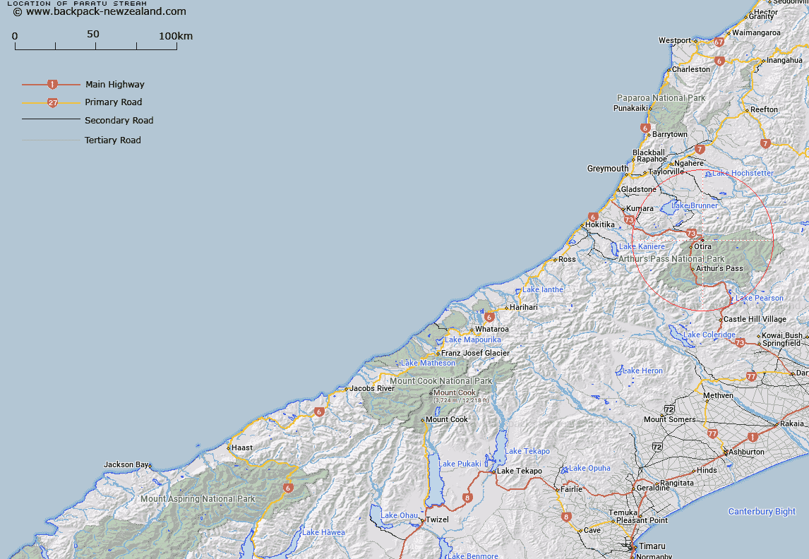
Map showing location of Paratu Stream


LINZ description: Right bank tributary of Otira River rising West of Waharoa Saddle, flowing westward and joining Otira River 500km downstream of Deception River. Block VII, Otira Survey District.
Latitude: -42.794424
Longitude: 171.620671
Northing: 5261091.1
Easting: 1487198.2
Land District: Westland
Feat Type: Stream


Scroll down to see a more detailed road map and below that a topographical map showing the location of Paratu Stream. The road map has been supplied by openstreetmap and the topographical map of Paratu Stream has been supplied by Land Information New Zealand (LINZ).

Yes you can use the top static map for you school/university project or personal website with a link back. Contact me for any commercial use.

Paratu Stream Map New Zealand


New Zealand places in our database
[ A ] [ B ] [ C ] [ D ] [ E ] [ F ] [ G ] [ H ] [ I ] [ J ] [ K ] [ L ] [ M ] [ N ] [ O ] [ P ] [ Q ] [ R ] [ S ] [ T ] [ U ] [ V ] [ W ] [ X ] [ Y ] [ Z ]


Closest 20 Streams to Paratu Stream

Twin Slip Creeks ( 2.19km )   Foggy Creek ( 2.64km )   Tutu Creek ( 2.84km )   Midday Creek ( 3.66km )   Clear Creek ( 4.08km )   Rocky Creek ( 4.16km )   Gorge Creek ( 4.35km )   Pfeifer Creek ( 4.44km )   Spray Creek ( 4.65km )   Lake Creek ( 4.83km )   Deception River ( 5.21km )   Nellies Creek ( 5.74km )   McDermotts Creek ( 6.04km )   Alexander Creek ( 6.19km )   Jacksons Creek ( 6.36km )   Hut Creek ( 6.49km )   Whaiti Stream ( 6.72km )   Kellys Creek ( 6.88km )   Otehake River ( 6.94km )   Shaffrey Creek ( 7.26km )   Barrack Creek ( 7.49km )   Goat Creek ( 7.91km )   Norths Creek ( 8.14km )   Main Creek ( 8.16km )   Toms Creek ( 8.79km )   Reef Creek ( 8.87km )   Wallaces Creek ( 9km )   Second Creek ( 9.15km )   Doreen Creek ( 9.19km )   Dorreen Creek ( 9.19km )   Holts Creek ( 9.28km )   Koropuku Creek ( 9.36km )   Good Luck Creek ( 9.44km )   Wesley Creek ( 9.44km )   Otehake River West Branch ( 9.73km )   Humphries Creek ( 9.98km )   Tawhana Stream ( 10.28km )   Jacksons Creek ( 10.35km )   Windy Point ( 10.37km )   Starvation Point ( 10.55km )