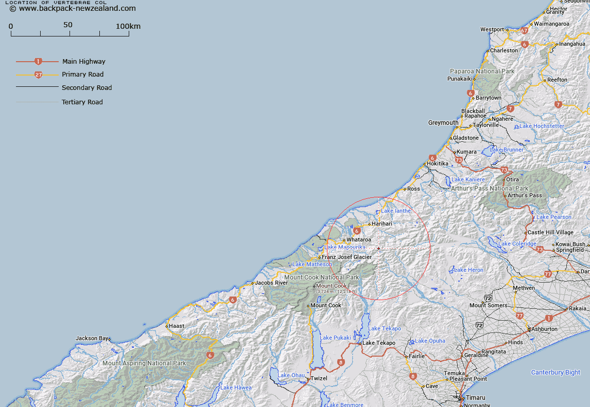
Map showing location of Vertebrae Col


LINZ description: Pass 1km South-east of Mount Barlow, the lowest point on the Devils Backbone ridge. Block II Tyndall Survey District.
Latitude: -43.321512
Longitude: 170.621536
Northing: 5200733.7
Easting: 1407145.8
Land District: Westland
Feat Type: Pass


Scroll down to see a more detailed road map and below that a topographical map showing the location of Vertebrae Col. The road map has been supplied by openstreetmap and the topographical map of Vertebrae Col has been supplied by Land Information New Zealand (LINZ).

Yes you can use the top static map for you school/university project or personal website with a link back. Contact me for any commercial use.

Vertebrae Col Map New Zealand


New Zealand places in our database
[ A ] [ B ] [ C ] [ D ] [ E ] [ F ] [ G ] [ H ] [ I ] [ J ] [ K ] [ L ] [ M ] [ N ] [ O ] [ P ] [ Q ] [ R ] [ S ] [ T ] [ U ] [ V ] [ W ] [ X ] [ Y ] [ Z ]


Closest 20 Passs to Vertebrae Col

Iceland Col ( 3.02km )   Angel Col ( 3.75km )   Adams Col ( 5.45km )   Havelock Col ( 6.15km )   Disappointment Saddle ( 7.38km )   Lucknow Saddle ( 7.77km )   Perth Col ( 7.77km )   Gunn Pass ( 8.11km )   Orb Col ( 8.17km )   Satan Saddle ( 9.02km )   Escape Col ( 10.2km )   Dennistoun Pass ( 10.5km )   Dummy Col ( 11.06km )   Hidden Col ( 11.44km )   Veil Col ( 11.69km )   Stewart Saddle ( 12.21km )   Fan Col ( 12.33km )   Sealy Pass ( 12.54km )   St Winifred Col ( 12.64km )   Terra Nova Pass ( 13.11km )   Lambert Col ( 13.62km )   Gadarene Col ( 14.04km )   Maud Pass ( 14.2km )   Jacqueline Col ( 14.41km )   Rangitata Col ( 14.6km )   Malcolm Col ( 14.63km )   McCoy Col ( 15.33km )   Grey Pass ( 15.9km )   Revelation Col ( 16.17km )   Separation Col ( 16.74km )   Easy Col ( 17.03km )   Twilight Col ( 17.81km )   Toledo Col ( 18.02km )   Battleaxe Col ( 18.19km )   Gladiator Col ( 18.42km )   Crossbow Saddle ( 18.92km )   Camp Saddle ( 19.75km )   Musterers Col ( 20.72km )   Bandolero Col ( 20.75km )   Strachan Pass ( 21.96km )