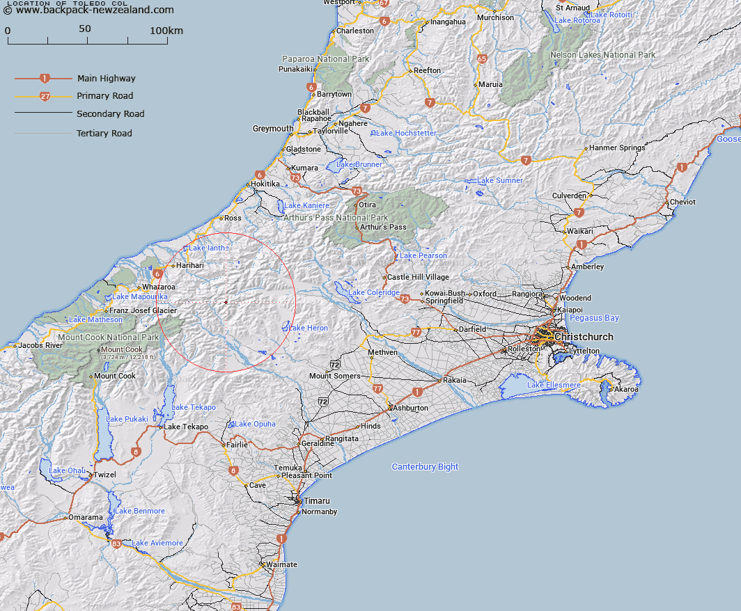
Map showing location of Toledo Col


LINZ description: Col between Nym Peak and Spearpoint Peak, on the Armoury Range. Ramsay Survey District.
Latitude: -43.340952
Longitude: 170.84268
Northing: 5199061.9
Easting: 1425133.3
Land District: Canterbury
Feat Type: Pass


Scroll down to see a more detailed road map and below that a topographical map showing the location of Toledo Col. The road map has been supplied by openstreetmap and the topographical map of Toledo Col has been supplied by Land Information New Zealand (LINZ).

Yes you can use the top static map for you school/university project or personal website with a link back. Contact me for any commercial use.

Toledo Col Map New Zealand


New Zealand places in our database
[ A ] [ B ] [ C ] [ D ] [ E ] [ F ] [ G ] [ H ] [ I ] [ J ] [ K ] [ L ] [ M ] [ N ] [ O ] [ P ] [ Q ] [ R ] [ S ] [ T ] [ U ] [ V ] [ W ] [ X ] [ Y ] [ Z ]


Closest 20 Passs to Toledo Col

Battleaxe Col ( 1km )   Crossbow Saddle ( 1.5km )   Gladiator Col ( 1.84km )   Bandolero Col ( 3km )   Musterers Col ( 3.15km )   McCoy Col ( 3.59km )   Rangitata Col ( 4.72km )   Ambrose Saddle ( 5.44km )   Malcolm Col ( 5.53km )   Lambert Col ( 6.12km )   Gadarene Col ( 6.65km )   Chowbok Col ( 8.64km )   Satan Saddle ( 10.03km )   Fan Col ( 10.11km )   Veil Col ( 10.29km )   Perth Col ( 10.32km )   Lucknow Saddle ( 10.32km )   Strachan Pass ( 10.4km )   Disappointment Saddle ( 11.29km )   Cameron Col ( 11.45km )   Camp Saddle ( 11.99km )   Menace Gap ( 12.24km )   Havelock Col ( 12.37km )   Orb Col ( 12.38km )   Adams Col ( 12.63km )   Lawrence Col ( 12.97km )   Reischek Col ( 13.67km )   Jagged Col ( 14.08km )   Angel Col ( 14.27km )   Groove Col ( 14.53km )   Peg Col ( 15.34km )   Boulder Col ( 16.11km )   Whitcombe Pass ( 16.77km )   Iceland Col ( 16.86km )   Erewhon Col ( 17.07km )   Full Moon Saddle ( 17.35km )   Gunn Pass ( 17.45km )   Vertebrae Col ( 18.02km )   Red Lion Col ( 18.05km )   McKenzie Col ( 19.44km )