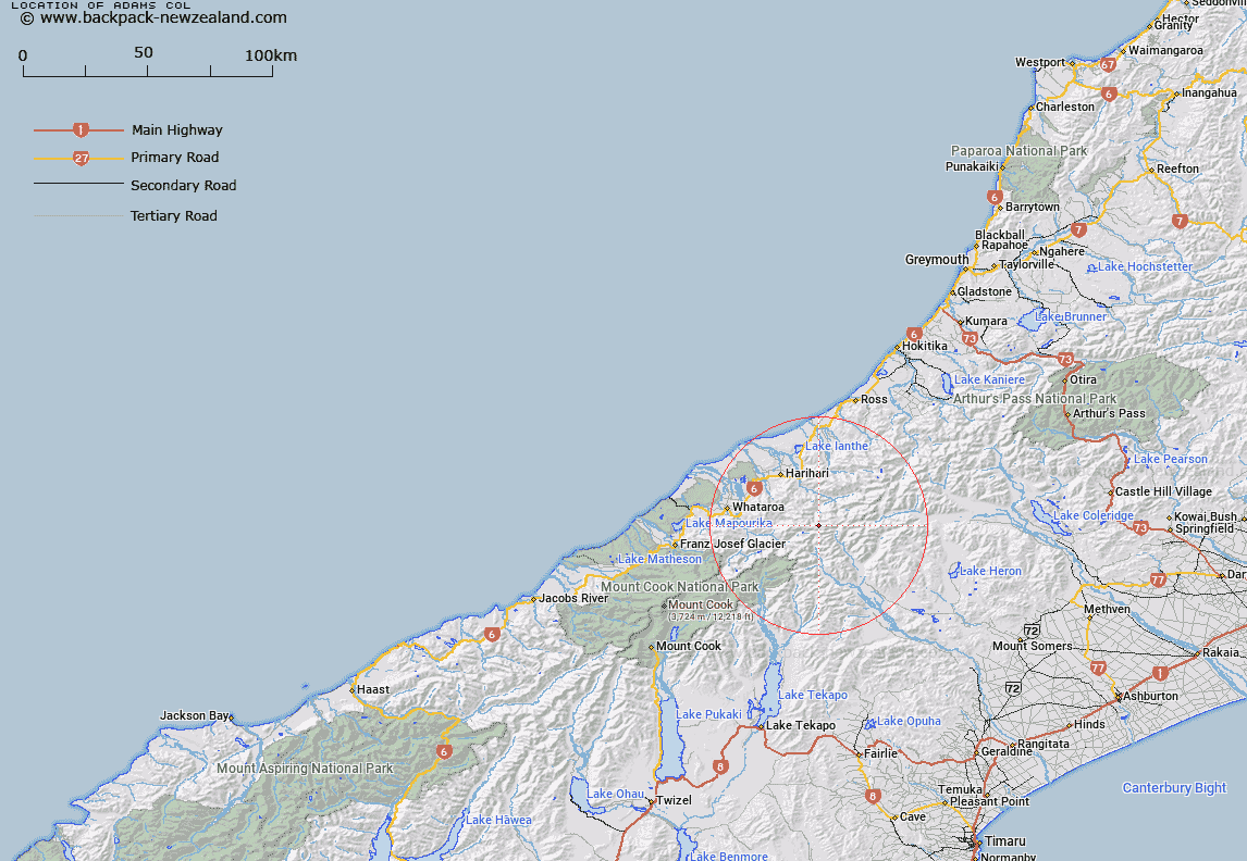
Map showing location of Adams Col


LINZ description: Col on John Pascoe Ridge between the Garden of Eden Ice Plateau and the Garden of Allah, East of Guardian Peak. Tyndall Survey District.
Latitude: -43.321567
Longitude: 170.688856
Northing: 5200881
Easting: 1412604.8
Land District: Westland
Feat Type: Pass


Scroll down to see a more detailed road map and below that a topographical map showing the location of Adams Col. The road map has been supplied by openstreetmap and the topographical map of Adams Col has been supplied by Land Information New Zealand (LINZ).

Yes you can use the top static map for you school/university project or personal website with a link back. Contact me for any commercial use.

Adams Col Map New Zealand


New Zealand places in our database
[ A ] [ B ] [ C ] [ D ] [ E ] [ F ] [ G ] [ H ] [ I ] [ J ] [ K ] [ L ] [ M ] [ N ] [ O ] [ P ] [ Q ] [ R ] [ S ] [ T ] [ U ] [ V ] [ W ] [ X ] [ Y ] [ Z ]


Closest 20 Passs to Adams Col

Angel Col ( 1.74km )   Havelock Col ( 2.69km )   Perth Col ( 2.75km )   Lucknow Saddle ( 2.75km )   Disappointment Saddle ( 3.43km )   Satan Saddle ( 3.92km )   Iceland Col ( 4.52km )   Vertebrae Col ( 5.45km )   Orb Col ( 5.59km )   Veil Col ( 8.23km )   Lambert Col ( 8.28km )   Gadarene Col ( 8.8km )   Fan Col ( 8.83km )   Gunn Pass ( 8.93km )   Rangitata Col ( 9.18km )   Malcolm Col ( 9.28km )   McCoy Col ( 9.89km )   Dennistoun Pass ( 11.95km )   Dummy Col ( 12.41km )   Toledo Col ( 12.63km )   Battleaxe Col ( 12.86km )   Hidden Col ( 12.91km )   Gladiator Col ( 12.98km )   Crossbow Saddle ( 13.6km )   St Winifred Col ( 13.96km )   Terra Nova Pass ( 14.38km )   Stewart Saddle ( 14.67km )   Escape Col ( 15.07km )   Camp Saddle ( 15.27km )   Musterers Col ( 15.43km )   Bandolero Col ( 15.43km )   Sealy Pass ( 15.69km )   Strachan Pass ( 16.99km )   Easy Col ( 17.17km )   Ambrose Saddle ( 17.72km )   Revelation Col ( 17.82km )   Maud Pass ( 17.93km )   Jacqueline Col ( 18.17km )   Separation Col ( 18.41km )   Menace Gap ( 19km )