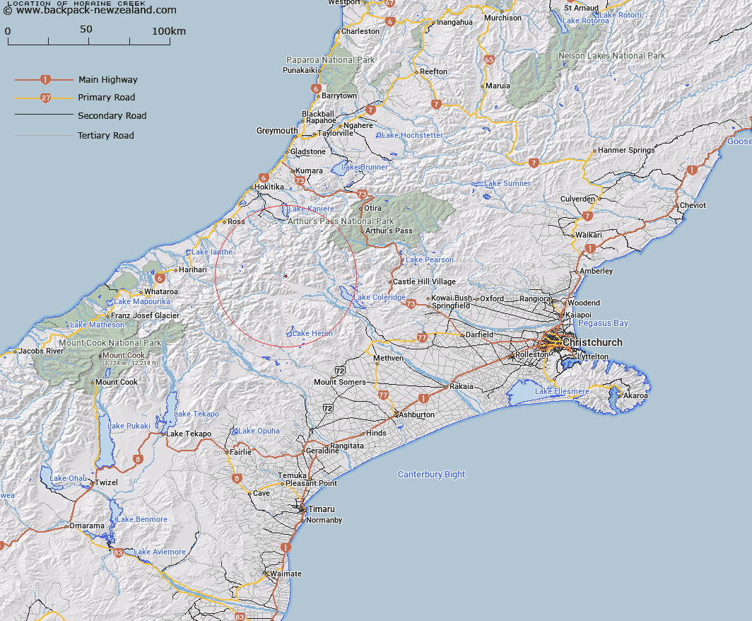
Map showing location of Moraine Creek


LINZ description: Stream Flowing south-westerly from Rolleston Range into Mathias River approximately 500m below its junction with West Mathias River. Mathias Survey District.
Latitude: -43.178815
Longitude: 171.151574
Northing: 5217669.3
Easting: 1449773.8
Land District: Canterbury
Feat Type: Stream


Scroll down to see a more detailed road map and below that a topographical map showing the location of Moraine Creek. The road map has been supplied by openstreetmap and the topographical map of Moraine Creek has been supplied by Land Information New Zealand (LINZ).

Yes you can use the top static map for you school/university project or personal website with a link back. Contact me for any commercial use.

Moraine Creek Map New Zealand


New Zealand places in our database
[ A ] [ B ] [ C ] [ D ] [ E ] [ F ] [ G ] [ H ] [ I ] [ J ] [ K ] [ L ] [ M ] [ N ] [ O ] [ P ] [ Q ] [ R ] [ S ] [ T ] [ U ] [ V ] [ W ] [ X ] [ Y ] [ Z ]


Closest 20 Streams to Moraine Creek

North Mathias River ( 3.23km )   Boundary Creek ( 3.71km )   Jerusalem Stream ( 4.71km )   Hut Stream ( 5.66km )   Mistake Creek ( 5.83km )   Mathias River ( 5.87km )   West Mathias River ( 6.66km )   South Mathias River ( 7.64km )   Appleyard Stream ( 7.96km )   Big Paddock Creek ( 8.09km )   Canyon Creek ( 8.15km )   Kiwi Stream ( 9.02km )   Revell Stream ( 9.1km )   Pukeko Stream ( 9.52km )   No. 1 Stream ( 9.84km )   Twin Creek ( 9.91km )   Totara Stream ( 10.11km )   Moa Stream ( 10.14km )   Rocky Spur Creek ( 10.55km )   North Stream ( 10.6km )   Broad Creek ( 10.66km )   No. 2 Stream ( 10.69km )   Big Fan Creek ( 10.89km )   Cattle Stream ( 10.89km )   No. 3 Stream ( 11.29km )   Chimera Stream ( 11.36km )   Jellicoe Stream ( 11.5km )   No. 4 Stream ( 11.68km )   No. 5 Stream ( 11.96km )   Harcourt Creek ( 12.04km )   Bond Creek ( 12.42km )   Cataract Creek ( 12.69km )   Chairmans Creek ( 12.73km )   Smyth Creek ( 12.75km )   Crack Creek ( 12.87km )   McWhirter Creek ( 12.95km )   Morley Creek ( 13.08km )   Steadman Creek ( 13.14km )   Sharpes Cascade ( 13.21km )   Snag Creek ( 13.55km )