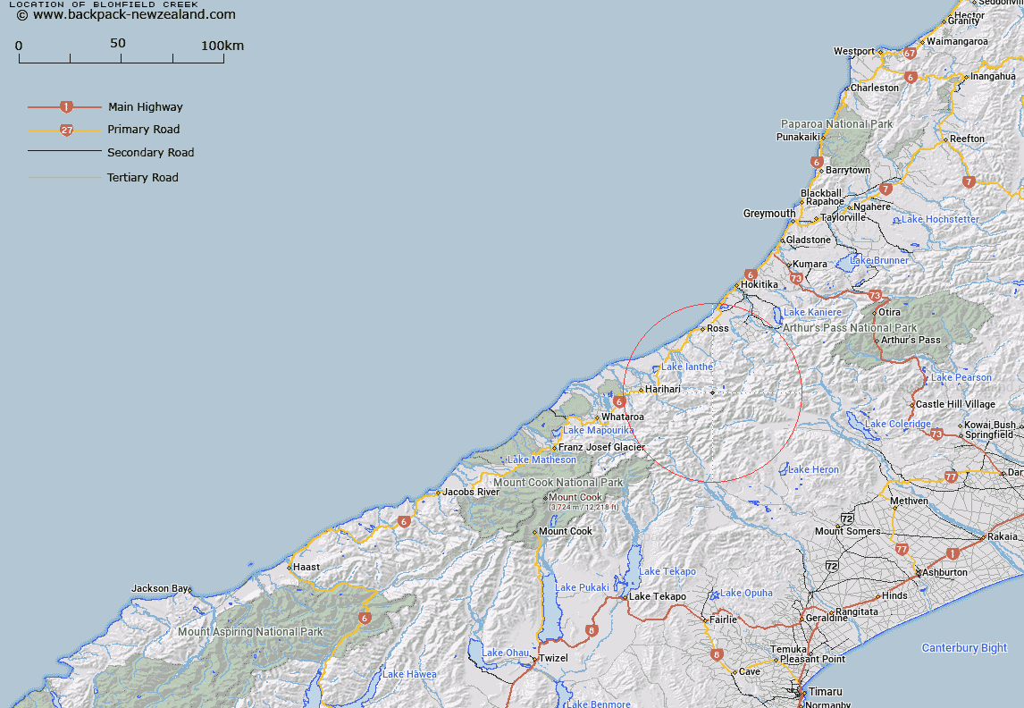
Map showing location of Blomfield Creek


LINZ description: A stream flowing generally west for approximately 2.5km from Artist Dome on Blomfield Range to its confluence with County Stream. NZTopo50-BW18 271187 (source) to 250193 (confluence).
Latitude: -43.160144
Longitude: 170.858864
Northing: 5219175.9
Easting: 1425930.8
Land District: Westland
Feat Type: Stream


Scroll down to see a more detailed road map and below that a topographical map showing the location of Blomfield Creek. The road map has been supplied by openstreetmap and the topographical map of Blomfield Creek has been supplied by Land Information New Zealand (LINZ).

Yes you can use the top static map for you school/university project or personal website with a link back. Contact me for any commercial use.

Blomfield Creek Map New Zealand


New Zealand places in our database
[ A ] [ B ] [ C ] [ D ] [ E ] [ F ] [ G ] [ H ] [ I ] [ J ] [ K ] [ L ] [ M ] [ N ] [ O ] [ P ] [ Q ] [ R ] [ S ] [ T ] [ U ] [ V ] [ W ] [ X ] [ Y ] [ Z ]


Closest 20 Streams to Blomfield Creek

County Stream ( 0.64km )   Canary Creek ( 1.7km )   O'Reilly Creek ( 2.26km )   Headwater Creek ( 2.52km )   Bradshaw Creek ( 3.33km )   Reid Creek ( 3.4km )   Smyth River ( 3.55km )   Drain Off Creek ( 3.59km )   Alexander Creek ( 3.86km )   Dorothy Creek ( 4.03km )   Chainman Creek ( 4.34km )   Stag Creek ( 4.46km )   Crevice Creek ( 4.56km )   Moonbeam Torrent ( 4.6km )   Noisy Torrent ( 4.89km )   Watson Creek ( 5.05km )   Galway Creek ( 5.25km )   Evans River ( 5.69km )   Devastation Creek ( 5.97km )   Antony Creek ( 5.99km )   Frame Pack Creek ( 6.07km )   Vane Stream ( 6.43km )   Mark Creek ( 6.6km )   Pot Luck Creek ( 6.88km )   Jumping Creek ( 6.93km )   Syme Stream ( 7.23km )   Seddon Creek ( 7.51km )   Bartrum Creek ( 7.9km )   Ken Torrent ( 7.91km )   Whirling Water ( 7.99km )   Isobel Stream ( 8.01km )   Pompey Creek ( 8.02km )   Midnight Torrent ( 8.03km )   Spar Creek ( 8.43km )   Walcott Creek ( 8.53km )   Wilkinson River ( 8.6km )   Caper Torrent ( 9.05km )   Jourdain Creek ( 9.08km )   Caesar Creek ( 9.33km )   Froth Creek ( 9.39km )