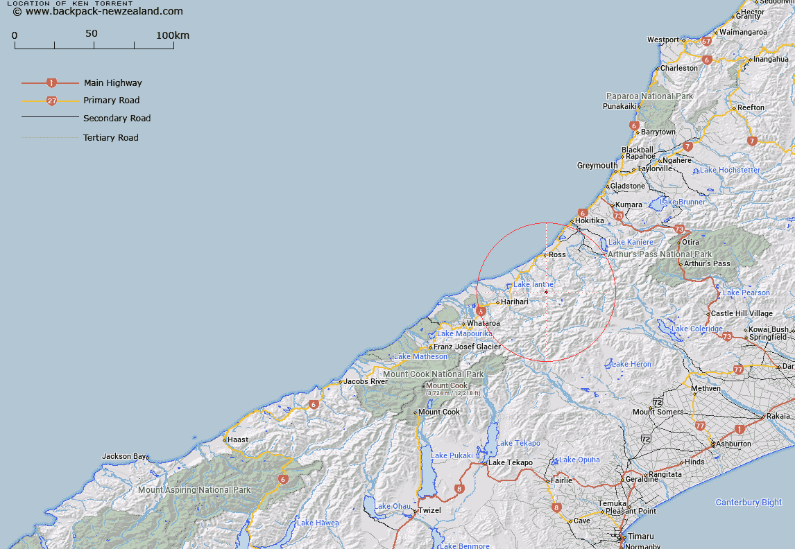
Map showing location of Ken Torrent
LINZ description: Stream immediately east of Syme Stream, flowing from 3km West of Ragged Peak in the Hitchen Range, and 1km East of Ridland Saddle, northward into the upper Kakapotahi River. Block II, Whitcombe Pass Survey District
Latitude: -43.093996
Longitude: 170.822846
Northing: 5226446.5
Easting: 1422811.6
Land District: Westland
Feat Type: Stream
Latitude: -43.093996
Longitude: 170.822846
Northing: 5226446.5
Easting: 1422811.6
Land District: Westland
Feat Type: Stream

Scroll down to see a more detailed road map and below that a topographical map showing the location of Ken Torrent. The road map has been supplied by openstreetmap and the topographical map of Ken Torrent has been supplied by Land Information New Zealand (LINZ).
Yes you can use the top static map for you school/university project or personal website with a link back. Contact me for any commercial use.
[ A ] [ B ] [ C ] [ D ] [ E ] [ F ] [ G ] [ H ] [ I ] [ J ] [ K ] [ L ] [ M ] [ N ] [ O ] [ P ] [ Q ] [ R ] [ S ] [ T ] [ U ] [ V ] [ W ] [ X ] [ Y ] [ Z ]