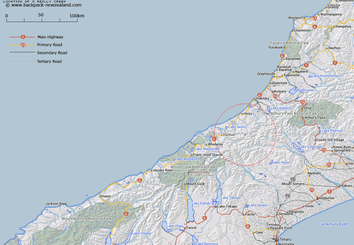
Map showing location of O'Reilly Creek


LINZ description: Stream considered to be the main route to Bloomfield Range. It is the high country route from the Kensington River to the Waitaha River over the Bloomfield Range.
Latitude: -43.142911
Longitude: 170.84405
Northing: 5221058.8
Easting: 1424677.1
Land District: Westland
Feat Type: Stream


Scroll down to see a more detailed road map and below that a topographical map showing the location of O'Reilly Creek. The road map has been supplied by openstreetmap and the topographical map of O'Reilly Creek has been supplied by Land Information New Zealand (LINZ).

Yes you can use the top static map for you school/university project or personal website with a link back. Contact me for any commercial use.

O'Reilly Creek Map New Zealand


New Zealand places in our database
[ A ] [ B ] [ C ] [ D ] [ E ] [ F ] [ G ] [ H ] [ I ] [ J ] [ K ] [ L ] [ M ] [ N ] [ O ] [ P ] [ Q ] [ R ] [ S ] [ T ] [ U ] [ V ] [ W ] [ X ] [ Y ] [ Z ]


Closest 20 Streams to O'Reilly Creek

Chainman Creek ( 2.09km )   Alexander Creek ( 2.15km )   Canary Creek ( 2.25km )   Blomfield Creek ( 2.26km )   Bloomfield Creek ( 2.26km )   Drain Off Creek ( 2.48km )   County Stream ( 2.5km )   Dorothy Creek ( 2.72km )   Moonbeam Torrent ( 3.1km )   Reid Creek ( 3.9km )   Antony Creek ( 4.04km )   Headwater Creek ( 4.08km )   Watson Creek ( 4.36km )   Stag Creek ( 4.48km )   Mark Creek ( 4.66km )   Syme Stream ( 5km )   Bradshaw Creek ( 5.04km )   Smyth River ( 5.26km )   Ken Torrent ( 5.7km )   Isobel Stream ( 5.76km )   Noisy Torrent ( 5.91km )   Pompey Creek ( 6.13km )   Galway Creek ( 6.24km )   Bartrum Creek ( 6.44km )   Crevice Creek ( 6.48km )   Frame Pack Creek ( 6.72km )   Whirling Water ( 6.73km )   Jumping Creek ( 7.06km )   Macgregor Creek ( 7.46km )   Caesar Creek ( 7.51km )   Devastation Creek ( 7.53km )   Evans River ( 7.77km )   Pot Luck Creek ( 8.15km )   Midnight Torrent ( 8.19km )   Vane Stream ( 8.47km )   Matai Creek ( 8.9km )   Labyrinth Creek ( 8.92km )   Seddon Creek ( 9.02km )   Spar Creek ( 9.14km )   Scamper Torrent ( 9.32km )