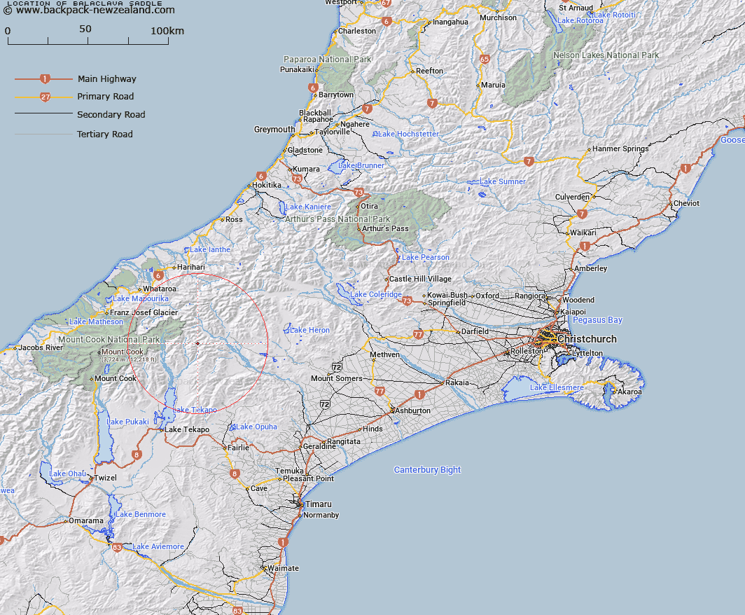
Map showing location of Balaclava Saddle


LINZ description: Mountain saddle 1.6km West North-west of Exeter Peak, between North East Gorge Stream and The Growler. Block VIII Godley Survey District.
Latitude: -43.546757
Longitude: 170.681578
Northing: 5175854.5
Easting: 1412710.8
Land District: Canterbury
Feat Type: Pass


Scroll down to see a more detailed road map and below that a topographical map showing the location of Balaclava Saddle. The road map has been supplied by openstreetmap and the topographical map of Balaclava Saddle has been supplied by Land Information New Zealand (LINZ).

Yes you can use the top static map for you school/university project or personal website with a link back. Contact me for any commercial use.

Balaclava Saddle Map New Zealand


New Zealand places in our database
[ A ] [ B ] [ C ] [ D ] [ E ] [ F ] [ G ] [ H ] [ I ] [ J ] [ K ] [ L ] [ M ] [ N ] [ O ] [ P ] [ Q ] [ R ] [ S ] [ T ] [ U ] [ V ] [ W ] [ X ] [ Y ] [ Z ]


Closest 20 Passs to Balaclava Saddle

Plata Col ( 1.12km )   Alma Col ( 4.01km )   Cassandra Col ( 4.39km )   Athene Col ( 5.71km )   Tom Thumb Col ( 6.95km )   Helen Col ( 7.05km )   Inkerman Saddle ( 8.53km )   Easy Col ( 8.57km )   Brabazon Saddle ( 9.03km )   Twilight Col ( 9.88km )   Separation Col ( 11.35km )   Revelation Col ( 11.63km )   Terra Nova Pass ( 13.09km )   St Winifred Col ( 13.53km )   Hidden Col ( 14.67km )   Dummy Col ( 14.88km )   Dennistoun Pass ( 15.43km )   Stewart Saddle ( 15.62km )   Sealy Pass ( 17.17km )   Gunn Pass ( 17.4km )   Fan Col ( 17.82km )   Veil Col ( 18.12km )   Maud Pass ( 18.85km )   Jacqueline Col ( 18.98km )   Stag Saddle ( 19.31km )   Orb Col ( 19.51km )   Grey Pass ( 20.02km )   Bullock Bow Saddle ( 21.19km )   Armadillo Saddle ( 21.21km )   Disappointment Saddle ( 21.9km )   Godley Pass ( 21.91km )   Rankin Pass ( 22.14km )   Havelock Col ( 22.36km )   Classen Saddle ( 22.65km )   Whataroa Saddle ( 23.18km )   Perth Col ( 23.46km )   Lucknow Saddle ( 23.46km )   Starvation Saddle ( 24.68km )   Angel Col ( 24.73km )   Adams Col ( 25.05km )