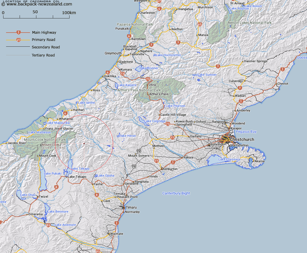
Map showing location of Cassandra Col


LINZ description: Mountain Pass between Myrmidon and Priam Peaks in the Two Thumb Range. Block IV Sinclair Survey District.
Latitude: -43.576167
Longitude: 170.718011
Northing: 5172669.7
Easting: 1415743.7
Land District: Canterbury
Feat Type: Pass


Scroll down to see a more detailed road map and below that a topographical map showing the location of Cassandra Col. The road map has been supplied by openstreetmap and the topographical map of Cassandra Col has been supplied by Land Information New Zealand (LINZ).

Yes you can use the top static map for you school/university project or personal website with a link back. Contact me for any commercial use.

Cassandra Col Map New Zealand


New Zealand places in our database
[ A ] [ B ] [ C ] [ D ] [ E ] [ F ] [ G ] [ H ] [ I ] [ J ] [ K ] [ L ] [ M ] [ N ] [ O ] [ P ] [ Q ] [ R ] [ S ] [ T ] [ U ] [ V ] [ W ] [ X ] [ Y ] [ Z ]


Closest 20 Passs to Cassandra Col

Athene Col ( 1.54km )   Alma Col ( 1.98km )   Tom Thumb Col ( 2.64km )   Helen Col ( 3.88km )   Balaclava Saddle ( 4.39km )   Balaclava Saddle ( 4.39km )   Brabazon Saddle ( 4.67km )   Plata Col ( 5.31km )   Inkerman Saddle ( 5.78km )   Easy Col ( 12.7km )   Twilight Col ( 14.27km )   Separation Col ( 15.74km )   Revelation Col ( 16.02km )   Stag Saddle ( 16.24km )   Bullock Bow Saddle ( 17.04km )   Terra Nova Pass ( 17.32km )   St Winifred Col ( 17.75km )   Hidden Col ( 18.86km )   Dummy Col ( 19.02km )   Dennistoun Pass ( 19.57km )   Stewart Saddle ( 19.96km )   Fan Col ( 20.55km )   Veil Col ( 20.94km )   Gunn Pass ( 21.3km )   Sealy Pass ( 21.55km )   Orb Col ( 22.82km )   Maud Pass ( 23.25km )   Jacqueline Col ( 23.37km )   Rankin Pass ( 24.28km )   Grey Pass ( 24.39km )   Armadillo Saddle ( 24.39km )   Godley Pass ( 24.72km )   Butler Saddle ( 24.93km )   Disappointment Saddle ( 25.12km )   Balmacaan Saddle ( 25.46km )   Havelock Col ( 25.72km )   Classen Saddle ( 26.36km )   Perth Col ( 26.58km )   Lucknow Saddle ( 26.58km )   Whataroa Saddle ( 26.98km )