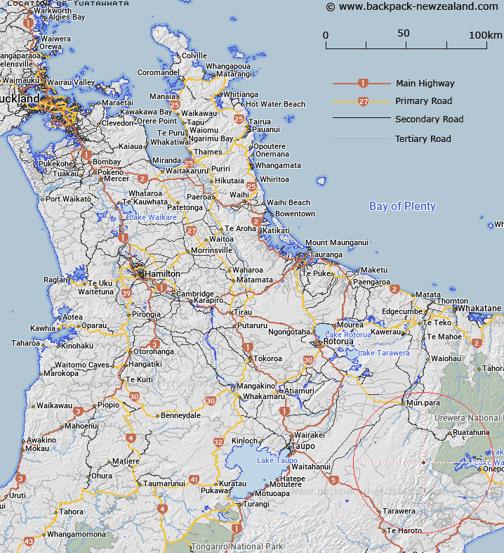
Map showing location of Tuatawhata


LINZ description: South Auckland portion of Survey District situated in South Auckland and Gisborne Land Districts and lying generally West of Lake Waikaremoana. Tuwatawata Survey District.
Latitude: -38.767295
Longitude: 176.81456
Northing: 5702132.2
Easting: 1931442
Land District: South Auckland
Feat Type: Appellation


Scroll down to see a more detailed road map and below that a topographical map showing the location of Tuatawhata. The road map has been supplied by openstreetmap and the topographical map of Tuatawhata has been supplied by Land Information New Zealand (LINZ).

Yes you can use the top static map for you school/university project or personal website with a link back. Contact me for any commercial use.

Tuatawhata Map New Zealand


New Zealand places in our database
[ A ] [ B ] [ C ] [ D ] [ E ] [ F ] [ G ] [ H ] [ I ] [ J ] [ K ] [ L ] [ M ] [ N ] [ O ] [ P ] [ Q ] [ R ] [ S ] [ T ] [ U ] [ V ] [ W ] [ X ] [ Y ] [ Z ]


Closest 20 Appellations to Tuatawhata

Tuatawhata ( 0km )   Tuawatawata ( 0km )   Tuwatawata ( 0km )   Wheao Survey District ( 29.51km )   Weao ( 29.51km )   Terapatiki Maori Block ( 33.15km )   Tarapatiki Maori Block ( 33.15km )   Matakuia Block ( 39.45km )   Matakuhia Block ( 39.45km )   Awa-o-totara Block ( 42.43km )   Waowaototara Block ( 42.43km )   Poututu Rural Sections ( 53.52km )   Hauruma Block ( 56.03km )   Huramua Block ( 56.03km )   Arapaoanoi Block ( 57.8km )   Aropaoanui Block ( 57.8km )   Hawke's Bay Land District ( 77.54km )   Whakapaupakihi ( 80.69km )   Whakapaupakahi ( 80.69km )   Tarewaeru ( 81.99km )   Tarewauru Block ( 81.99km )   Oriwha ( 82.85km )   Orewha ( 82.85km )   Tiro-o-Tane ( 86.47km )   Tiraotane Block ( 86.47km )   Paipaitahi ( 87.78km )   Paepaetahi ( 87.78km )   Waiotahi Parish ( 89.22km )   Waiotahe Parish ( 89.22km )   Waioeka Parish ( 92.08km )   Te Hahaenga Block ( 95.48km )   Te Hahainga ( 95.48km )   Poukokonga Block ( 95.57km )   Pokokonga ( 95.57km )   Awaateatua Survey District ( 98.25km )   Ngatira ( 101.23km )   Ngatiira ( 101.23km )   Waiari Settlement ( 112.46km )   Waire Settlement ( 112.46km )   Waiaua East Survey District ( 113.1km )