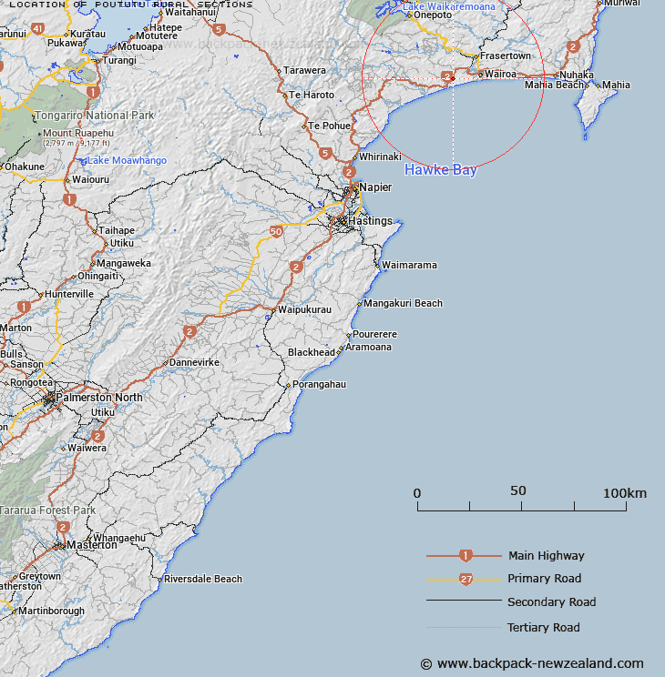
Map showing location of Poututu Rural Sections


LINZ description: Approximately 500m south of the Palmerston North Gisborne Railway line between Waihua and Ohinepaka.
Latitude: -39.056581
Longitude: 177.309005
Northing: 5668100
Easting: 1972900
Land District: Hawke's Bay
Feat Type: Appellation


Scroll down to see a more detailed road map and below that a topographical map showing the location of Poututu Rural Sections. The road map has been supplied by openstreetmap and the topographical map of Poututu Rural Sections has been supplied by Land Information New Zealand (LINZ).

Yes you can use the top static map for you school/university project or personal website with a link back. Contact me for any commercial use.

Poututu Rural Sections Map New Zealand


New Zealand places in our database
[ A ] [ B ] [ C ] [ D ] [ E ] [ F ] [ G ] [ H ] [ I ] [ J ] [ K ] [ L ] [ M ] [ N ] [ O ] [ P ] [ Q ] [ R ] [ S ] [ T ] [ U ] [ V ] [ W ] [ X ] [ Y ] [ Z ]


Closest 20 Appellations to Poututu Rural Sections

Huramua Block ( 7.92km )   Hauruma Block ( 7.92km )   Terapatiki Maori Block ( 24.4km )   Tarapatiki Maori Block ( 24.4km )   Matakuhia Block ( 30.87km )   Matakuia Block ( 30.87km )   Waowaototara Block ( 37.64km )   Awa-o-totara Block ( 37.64km )   Aropaoanui Block ( 38.59km )   Arapaoanoi Block ( 38.59km )   Tarewauru Block ( 51.43km )   Tarewaeru ( 51.43km )   Tuawatawata ( 53.52km )   Tuatawhata ( 53.52km )   Tuwatawata ( 53.52km )   Tiraotane Block ( 53.62km )   Tiro-o-Tane ( 53.62km )   Hawke's Bay Land District ( 59.39km )   Te Hahainga ( 66.11km )   Te Hahaenga Block ( 66.11km )   Pokokonga ( 66.14km )   Poukokonga Block ( 66.14km )   Paipaitahi ( 70.23km )   Paepaetahi ( 70.23km )   Orewha ( 76.57km )   Oriwha ( 76.57km )   Wheao Survey District ( 82.7km )   Weao ( 82.7km )   Whakapaupakahi ( 87.47km )   Whakapaupakihi ( 87.47km )   Kahuranaki Crown Grant District ( 89.87km )   Kauranaki Crown Grant District ( 89.87km )   Tutamoi Block ( 106.8km )   Tutamoe Block ( 106.8km )   Matatuotonga Block ( 111.42km )   Matuatonga Block ( 111.42km )   Waioeka Parish ( 112.46km )   Waiotahe Parish ( 114.24km )   Waiotahi Parish ( 114.24km )   Tutamoi Survey District ( 115.58km )