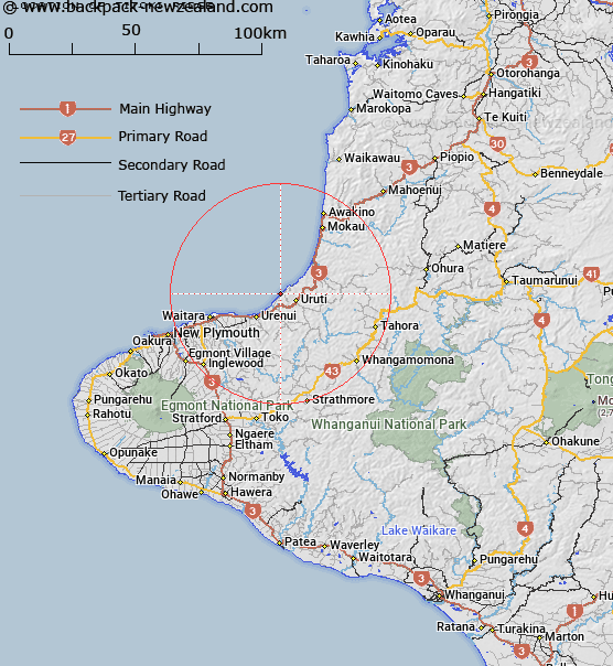
Map showing location of Titoki Ridge


LINZ description: Coastal ridge. 260–Q18, grid reference 381529
Latitude: -38.919697
Longitude: 174.475345
Northing: 5691100
Easting: 1727900
Land District: Taranaki
Feat Type: Ridge


Scroll down to see a more detailed road map and below that a topographical map showing the location of Titoki Ridge. The road map has been supplied by openstreetmap and the topographical map of Titoki Ridge has been supplied by Land Information New Zealand (LINZ).

Yes you can use the top static map for you school/university project or personal website with a link back. Contact me for any commercial use.

Titoki Ridge Map New Zealand


New Zealand places in our database
[ A ] [ B ] [ C ] [ D ] [ E ] [ F ] [ G ] [ H ] [ I ] [ J ] [ K ] [ L ] [ M ] [ N ] [ O ] [ P ] [ Q ] [ R ] [ S ] [ T ] [ U ] [ V ] [ W ] [ X ] [ Y ] [ Z ]


Closest 20 Ridges to Titoki Ridge

The Razorback ( 52.56km )   The Puffer ( 52.73km )   North Ridge ( 53.87km )   Carrington Ridge ( 53.96km )   Dover Spur ( 54.24km )   Lizard ( 54.46km )   East Ridge ( 54.56km )   Turtle ( 54.77km )   Curtis Ridge ( 54.86km )   Mackay Rocks ( 54.97km )   Skeet Ridge ( 56.1km )   Bobs Ridge ( 56.57km )   West Ridge ( 56.91km )   Raepahu Ridge ( 88.17km )   Pinnacle Ridge ( 101.39km )   Waihohonu Ridge ( 102.86km )   Te Hiwiokaituri ( 129.16km )   Rogers Spur ( 129.78km )   Forks Spur ( 140.53km )   The Pinnacles ( 140.74km )   Pawerawera Ridge ( 141.2km )   Tin Kettle Spur ( 141.34km )   Taurangatao Spur ( 145.47km )   Taumata Ridge ( 151.87km )   The Paradise ( 157.44km )   Spion Kop ( 160.94km )   The Hermitage ( 161.72km )   Ohutu Ridge ( 162.02km )   Wild Sheep Spur ( 164.72km )   Back Ridge ( 165.31km )   The Rogue ( 168.3km )   Papakiakuta Ridge ( 169.52km )   Ihaka Spur ( 169.52km )   Camp Spur ( 169.76km )   Makahu Spur ( 169.92km )   Coxcomb Spur ( 170.11km )   Dicks Spur ( 170.15km )   Dons Spur ( 170.37km )   Pinnacle Spur ( 170.62km )   Dirty Spur ( 170.98km )