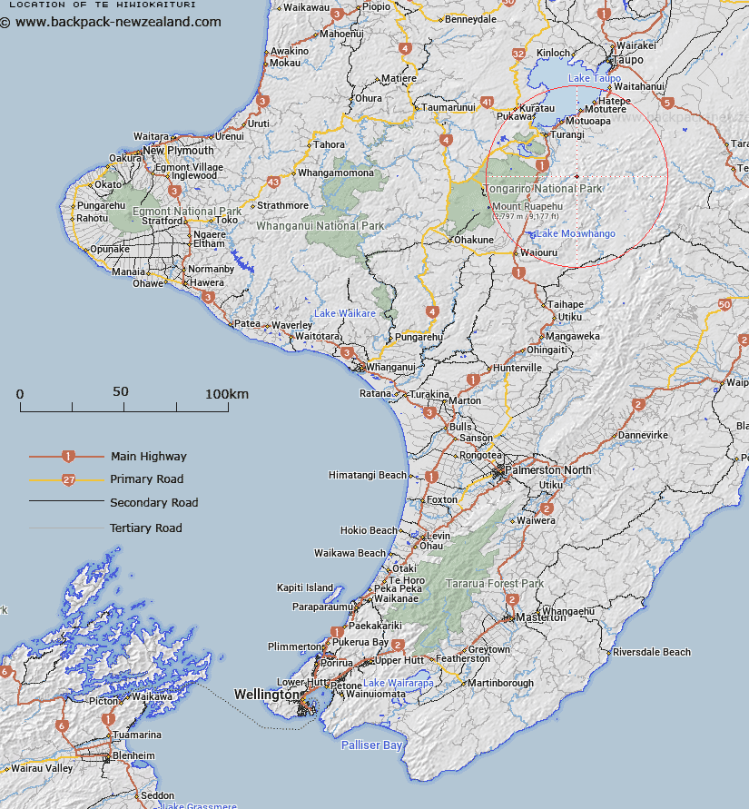
Map showing location of Te Hiwiokaituri


LINZ description: Ridge 4 kms long in Kaimanawa State Forest, north of Thunderbolt Creek.
Latitude: -39.15596
Longitude: 175.939505
Northing: 5661800
Easting: 1854000
Land District: Wellington
Feat Type: Ridge


Scroll down to see a more detailed road map and below that a topographical map showing the location of Te Hiwiokaituri. The road map has been supplied by openstreetmap and the topographical map of Te Hiwiokaituri has been supplied by Land Information New Zealand (LINZ).

Yes you can use the top static map for you school/university project or personal website with a link back. Contact me for any commercial use.

Te Hiwiokaituri Map New Zealand


New Zealand places in our database
[ A ] [ B ] [ C ] [ D ] [ E ] [ F ] [ G ] [ H ] [ I ] [ J ] [ K ] [ L ] [ M ] [ N ] [ O ] [ P ] [ Q ] [ R ] [ S ] [ T ] [ U ] [ V ] [ W ] [ X ] [ Y ] [ Z ]


Closest 20 Ridges to Te Hiwiokaituri

Pawerawera Ridge ( 12.15km )   Tin Kettle Spur ( 13.35km )   Taurangatao Spur ( 16.41km )   Forks Spur ( 17.33km )   The Pinnacles ( 20.59km )   Rogers Spur ( 26.91km )   Spion Kop ( 32.48km )   Waihohonu Ridge ( 32.64km )   Pinnacle Ridge ( 33.48km )   Back Ridge ( 36.71km )   Ihaka Spur ( 40.41km )   Camp Spur ( 40.61km )   The Rogue ( 40.63km )   Makahu Spur ( 41.1km )   Dicks Spur ( 41.13km )   Coxcomb Spur ( 41.54km )   Dons Spur ( 41.67km )   Pinnacle Spur ( 41.69km )   Taumata Ridge ( 43.24km )   Matauria Ridge ( 44.76km )   Mackintosh Spur ( 45.93km )   The Blowhard ( 47.26km )   The Hermitage ( 49.05km )   Blowhard Ridge ( 49.1km )   Wild Sheep Spur ( 49.19km )   Sandy Ridge ( 50.84km )   The Lizard ( 50.9km )   The Paradise ( 51.8km )   Ohutu Ridge ( 55.76km )   Hollowback Ridge ( 56.99km )   Herrick Spur ( 58.2km )   Bob Spur ( 60.4km )   Golden Crown Spur ( 60.92km )   Golden Crown Ridge ( 61.02km )   Jumped Up Spur ( 61.98km )   Totara Spur ( 62.53km )   Te Waka-o-Ng?rangikataka Ridge ( 62.93km )   Papakiakuta Ridge ( 64.57km )   Colenso Spur ( 66.77km )   Long Spur ( 73.24km )