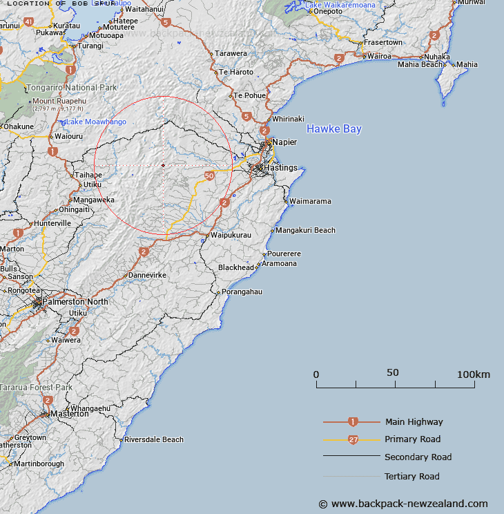
Map showing location of Bob Spur


LINZ description: Running south from Three Fingers Peak to Frying Pan Flat. Ngaruroro Survey District.
Latitude: -39.61997
Longitude: 176.304986
Northing: 5609200
Easting: 1883700
Land District: Hawke's Bay
Feat Type: Ridge


Scroll down to see a more detailed road map and below that a topographical map showing the location of Bob Spur. The road map has been supplied by openstreetmap and the topographical map of Bob Spur has been supplied by Land Information New Zealand (LINZ).

Yes you can use the top static map for you school/university project or personal website with a link back. Contact me for any commercial use.

Bob Spur Map New Zealand


New Zealand places in our database
[ A ] [ B ] [ C ] [ D ] [ E ] [ F ] [ G ] [ H ] [ I ] [ J ] [ K ] [ L ] [ M ] [ N ] [ O ] [ P ] [ Q ] [ R ] [ S ] [ T ] [ U ] [ V ] [ W ] [ X ] [ Y ] [ Z ]


Closest 20 Ridges to Bob Spur

Golden Crown Ridge ( 1.06km )   Golden Crown Spur ( 1.65km )   Herrick Spur ( 2.65km )   Jumped Up Spur ( 3.35km )   Hollowback Ridge ( 5.03km )   Totara Spur ( 9.61km )   Wild Sheep Spur ( 11.64km )   Colenso Spur ( 13.92km )   The Hermitage ( 13.98km )   Long Spur ( 15.61km )   Papakiakuta Ridge ( 16.07km )   Ohutu Ridge ( 16.66km )   The Paradise ( 20km )   The Lizard ( 22.65km )   Taumata Ridge ( 23.85km )   The Blowhard ( 24.6km )   Sandy Ridge ( 25.02km )   Blowhard Ridge ( 25.68km )   Hinerua Ridge ( 27.31km )   Broken Ridge ( 29.06km )   Black Ridge ( 31.37km )   Government Spur ( 31.45km )   The Rogue ( 32.16km )   Sawtooth Ridge ( 32.29km )   Mackintosh Spur ( 32.49km )   Matauria Ridge ( 34.74km )   Daphne Ridge ( 34.85km )   Dirty Spur ( 34.9km )   Daphne Spur ( 35.35km )   Coxcomb Spur ( 36.61km )   Dons Spur ( 37.53km )   Back Ridge ( 37.64km )   Spion Kop ( 38.2km )   Makahu Spur ( 38.52km )   Pinnacle Spur ( 39.62km )   The Pinnacles ( 40.48km )   Dicks Spur ( 40.8km )   Ihaka Spur ( 42.3km )   Forks Spur ( 43.14km )   Camp Spur ( 43.47km )