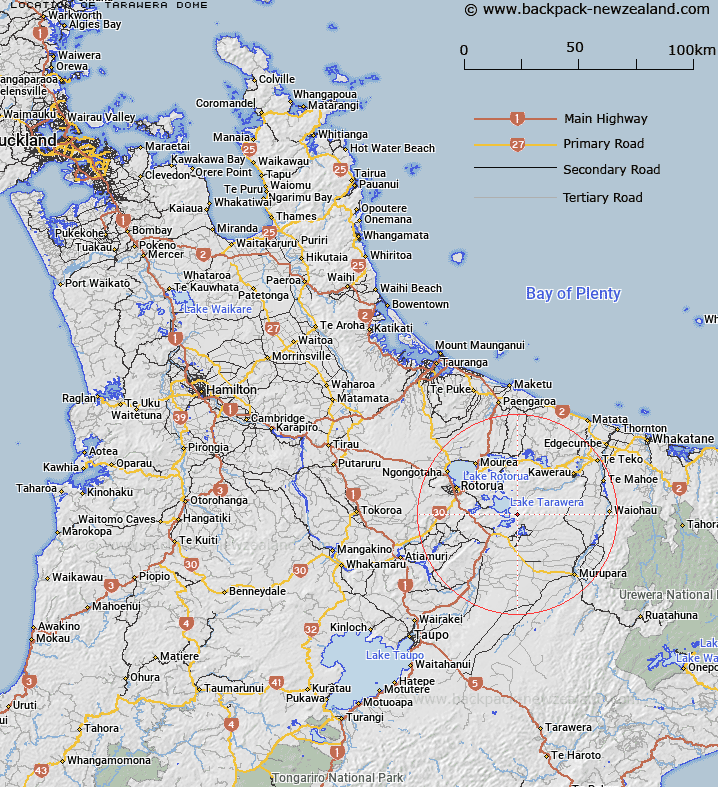
Map showing location of Tarawera Dome


LINZ description: This name applies to the south-western peak of the mountain
Latitude: -38.235894
Longitude: 176.48403
Northing: 5762269.3
Easting: 1904950.5
Land District: South Auckland
Feat Type: Hill


Scroll down to see a more detailed road map and below that a topographical map showing the location of Tarawera Dome. The road map has been supplied by openstreetmap and the topographical map of Tarawera Dome has been supplied by Land Information New Zealand (LINZ).

Yes you can use the top static map for you school/university project or personal website with a link back. Contact me for any commercial use.

Tarawera Dome Map New Zealand


New Zealand places in our database
[ A ] [ B ] [ C ] [ D ] [ E ] [ F ] [ G ] [ H ] [ I ] [ J ] [ K ] [ L ] [ M ] [ N ] [ O ] [ P ] [ Q ] [ R ] [ S ] [ T ] [ U ] [ V ] [ W ] [ X ] [ Y ] [ Z ]


Closest 20 Hills to Tarawera Dome

Koa ( 0.96km )   Mount Tarawera ( 1.42km )   Ruawahia Dome ( 2.17km )   Ruawahia Peak ( 2.17km )   Ngawhiro ( 2.53km )   Te Kanakana Dome ( 3.38km )   Kanakana ( 3.57km )   Wahanga Peak ( 3.77km )   Wahanga Dome ( 3.77km )   Pukehou ( 4.29km )   Ridge Dome ( 4.59km )   Te Kauae ( 5.16km )   Waikakareao ( 5.79km )   Oruakorako Hill ( 7.06km )   Rotomahana ( 7.08km )   Hapeotoroa ( 7.82km )   Pariwhaiti ( 9.76km )   Waimangu ( 10.32km )   Makatiti Dome ( 10.66km )   Wairua ( 11.06km )   Tutaeheke ( 12.13km )   Puhipuhi ( 12.25km )   Rainbow Mountain ( 12.49km )   Maunga K?karamea ( 12.49km )   Maungakakaramea ( 12.49km )   Tutehu ( 13.83km )   Pukerimu ( 14.07km )   Te Monehu ( 15.03km )   Maungawhakamana ( 15.14km )   Waikorapa ( 15.33km )   Tuahu ( 15.35km )   Oteranginui ( 15.51km )   Pukepoto Hill ( 15.67km )   Moerangi ( 15.84km )   Maungaongaonga ( 15.89km )   Tumunui Hill ( 16.31km )   Haroharo ( 16.34km )   Opawhero Hill ( 16.36km )   Whakapoungakau ( 17.56km )   Rangitoto Peak ( 17.56km )