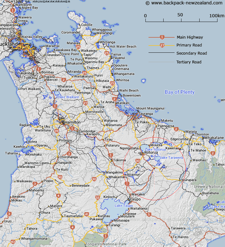
Map showing location of Maungakakaramea
LINZ description: A 743m hill feature located at the intersection of State Highway 5 and State Highway 38, approximately 25 km southeast of Rotorua. Beaconed geodetic mark 3081 and a transmission mast are located at the summit. The hill is part of the ‘Rainbow Mountain Scenic Reserve’. Feature shown on: NZMS260 U16 Edition 1 1982; NZTopo50-BF37 962533.
Latitude: -38.319188
Longitude: 176.388098
Northing: 5753335.5
Easting: 1896212.3
Land District: South Auckland
Feat Type: Hill
Latitude: -38.319188
Longitude: 176.388098
Northing: 5753335.5
Easting: 1896212.3
Land District: South Auckland
Feat Type: Hill

Scroll down to see a more detailed road map and below that a topographical map showing the location of Maungakakaramea. The road map has been supplied by openstreetmap and the topographical map of Maungakakaramea has been supplied by Land Information New Zealand (LINZ).
Yes you can use the top static map for you school/university project or personal website with a link back. Contact me for any commercial use.
[ A ] [ B ] [ C ] [ D ] [ E ] [ F ] [ G ] [ H ] [ I ] [ J ] [ K ] [ L ] [ M ] [ N ] [ O ] [ P ] [ Q ] [ R ] [ S ] [ T ] [ U ] [ V ] [ W ] [ X ] [ Y ] [ Z ]