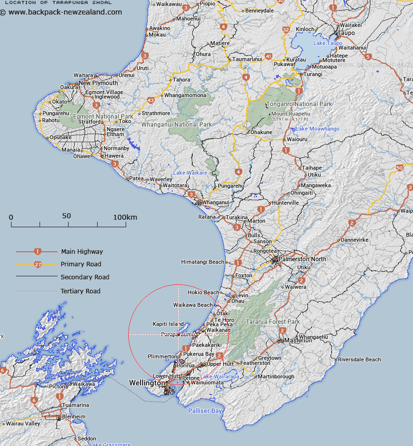
Map showing location of Tarapunga Shoal


LINZ description: Northern Cook Strait A 6-fathom shoal lying approximately 1 mile south of Kapiti Island. Rises to 11 m
Latitude: -40.904167
Longitude: 174.868
Northing: 5470201.6
Easting: 1757333
Land District: Wellington
Feat Type: Shoal


Scroll down to see a more detailed road map and below that a topographical map showing the location of Tarapunga Shoal. The road map has been supplied by openstreetmap and the topographical map of Tarapunga Shoal has been supplied by Land Information New Zealand (LINZ).

Yes you can use the top static map for you school/university project or personal website with a link back. Contact me for any commercial use.

Tarapunga Shoal Map New Zealand


New Zealand places in our database
[ A ] [ B ] [ C ] [ D ] [ E ] [ F ] [ G ] [ H ] [ I ] [ J ] [ K ] [ L ] [ M ] [ N ] [ O ] [ P ] [ Q ] [ R ] [ S ] [ T ] [ U ] [ V ] [ W ] [ X ] [ Y ] [ Z ]


Closest 20 Shoals to Tarapunga Shoal

The Bridge ( 22.94km )   Hope Shoal ( 43.55km )   Falcon Shoals ( 44.83km )   Perano Shoal ( 73.57km )   Ruby Shoal ( 192.92km )   Paturau Shoal ( 208.61km )   Kahurangi Shoals ( 227.56km )   Price Shoal ( 313.51km )   Scott Shoal ( 314.96km )   H?wini Rocks ( 327.61km )   Town Shoals ( 379.67km )   Tokeroa Shoal ( 386.69km )   Motunau Patch ( 387.84km )   Brewis Shoal ( 392.39km )   Penguin Shoal ( 404.85km )   Western Shoals ( 429.06km )   Albert Shoal ( 495.82km )   Eclipse Shoal ( 499.17km )   South Spit ( 500.88km )   Iris Shoal ( 501.15km )   Southern Shoals ( 501.3km )   Tory Shoal ( 503.22km )   Outer Southern Shoal ( 503.3km )   North Spit ( 507.11km )   Middle Shoal ( 566.73km )   Outer Shoal ( 568.41km )   Slains Castle ( 638.63km )   Ruahine Shoal ( 672.43km )   Te Puke te Huri Spit ( 686.16km )   Maratea Shoals ( 786.31km )   Dragon Teeth Shoals ( 786.31km )   Davey Shoal ( 821.06km )   Entrance Shoal ( 822.23km )   Lachlan Shoals ( 839.21km )   Wairau Shoal ( 846.37km )   Polybank Shoal ( 850.3km )   Mason Shallows ( 877.56km )